Churu (Bolivia)
This article is about the mountain in Bolivia. For the municipality in Rajasthan, India, see Churu. For its namesake district, see Churu district. For the village in Iran, see Churu, Iran.
| Churu | |
|---|---|
 Churu | |
| Elevation | 5,200 m (17,100 ft)[1] |
| Location | |
| Range | Andes, Cordillera Real |
| Coordinates | 16°32′40″S 67°50′26″W / 16.54444°S 67.84056°WCoordinates: 16°32′40″S 67°50′26″W / 16.54444°S 67.84056°W |
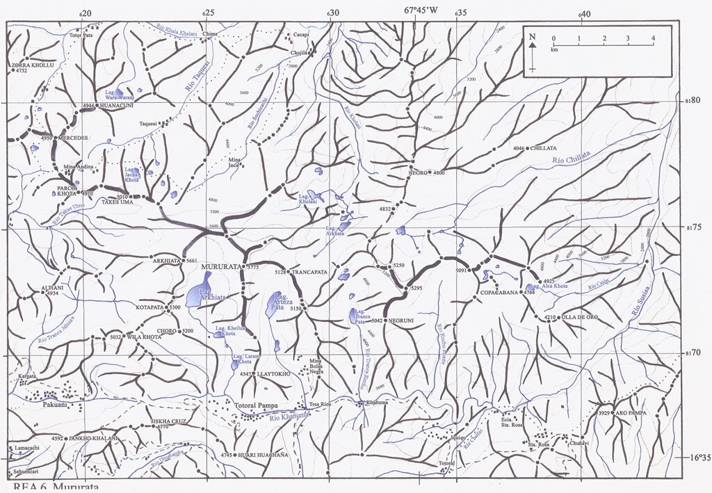
Churu (Aymara for a small waru waru / a lump,[2] hispanicized spelling Choro) is a 5,200 metres (17,060 ft) high mountain in the Cordillera Real in the Bolivian Andes. It is situated in the La Paz Department, Sud Yungas Province, Irupana Municipality, near the border with the Murillo Province, Palca Municipality. Churu lies south-west of the mountain Mururata, west of a small lake named Qillwa Quta ("gull lake", Khellhua Khota), east of the mountain Wila Quta and south-east of the mountain Qutapata.[1][3]
References
- ↑ 1.0 1.1 "Cordillera Real". huayna-potosi.com. Retrieved August 25, 2014.
- ↑ Radio San Gabriel, "Instituto Radiofonico de Promoción Aymara" (IRPA) 1993, Republicado por Instituto de las Lenguas y Literaturas Andinas-Amazónicas (ILLLA-A) 2011, Transcripción del Vocabulario de la Lengua Aymara, P. Ludovico Bertonio 1612 (Spanish-Aymara-Aymara-Spanish dictionary)
- ↑ "Irupana". INE, Bolivia. Retrieved August 25, 2014.