Chouvigny
| Chouvigny | ||
|---|---|---|
|
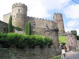
The chateau in Chouvigny | ||
| ||
 Chouvigny | ||
|
Location within Auvergne region  Chouvigny | ||
| Coordinates: 46°07′37″N 2°59′30″E / 46.1269°N 2.9917°ECoordinates: 46°07′37″N 2°59′30″E / 46.1269°N 2.9917°E | ||
| Country | France | |
| Region | Auvergne | |
| Department | Allier | |
| Arrondissement | Montluçon | |
| Canton | Ébreuil | |
| Intercommunality | Sioule, Colettes et Bouble | |
| Government | ||
| • Mayor (2008–2014) | Serge Lejeune | |
| Area1 | 13.41 km2 (5.18 sq mi) | |
| Population (2008)2 | 239 | |
| • Density | 18/km2 (46/sq mi) | |
| INSEE/Postal code | 03078 / 03450 | |
| Elevation |
310–584 m (1,017–1,916 ft) (avg. 471 m or 1,545 ft) | |
|
1 French Land Register data, which excludes lakes, ponds, glaciers > 1 km² (0.386 sq mi or 247 acres) and river estuaries. 2 Population without double counting: residents of multiple communes (e.g., students and military personnel) only counted once. | ||
.svg.png)
Chouvigny is a commune in the Allier department in central France.
Population
| Historical population | ||
|---|---|---|
| Year | Pop. | ±% |
| 1962 | 340 | — |
| 1968 | 349 | +2.6% |
| 1975 | 265 | −24.1% |
| 1982 | 255 | −3.8% |
| 1990 | 240 | −5.9% |
| 1999 | 238 | −0.8% |
| 2008 | 239 | +0.4% |
See also
References
| Wikimedia Commons has media related to Chouvigny. |