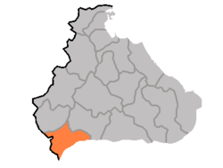
Chorwon County
| Chorwon County 철원군 | |
|---|---|
| County | |
| Korean transcription(s) | |
| • Chosŏn'gŭl | 철원군 |
| • Hancha | 鐵原郡 |
| • McCune-Reischauer | Ch'ŏrwŏn kun |
| • Revised Romanization | Cheorwon-gun |
 | |
| Country | North Korea |
| Province | Kangwon Province |
| Administrative divisions | 1 ŭp, 36 ri |
| Area | |
| • Total | 457 km2 (176 sq mi) |
| Population (1991 est.) | |
| • Total | 100,000 |
Chorwon County is a kun, or county, in Kangwon province, North Korea. Portions of it were once a single county together with the county of the same name in South Korea; other portions were added from neighboring counties in the 1956 reorganization of local governments.[1] After the initial division of Korea, the entire county lay to the Northern side of the dividing line, but in the course of the Korean War part of the county was taken by the South.
The county's terrain is mountainous in the north, but gradually more level towards the south. The Masikryong Mountains pass through the county; the highest point of which is the 1,360-metre (4,460 ft) Taehwa Peak (대왕덕산). The chief watercourse is the Rimjin River. Approximately 54% of the county's area is occupied by forests.
The chief local industry is agriculture. The county is a major producer of rice for North Korea. Additional crops include maize, soybeans, wheat, and barley. Other local industries include mining, sericulture, and orcharding. The county is host to deposits of coal, iron ore, magnetite, and manganese. There is little manufacturing.
The county is not connected to the national rail grid, but is served by roads.
Notes
See also
- Geography of North Korea
- Administrative divisions of North Korea
- Kangwon (North Korea)
External links
- (Korean) In Korean language online encyclopedias:
| ||||||||||||||||