Chornomorske
| Chornomorske Чорноморське/Черноморское/Aqmeçit | ||
|---|---|---|
| Urban-type settlement | ||
|
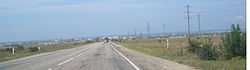
View of Chornomorske | ||
| ||
.svg.png) Chornomorske Location of Chornomorske in Crimea | ||
| Coordinates: 45°30′07″N 32°42′09″E / 45.50194°N 32.70250°ECoordinates: 45°30′07″N 32°42′09″E / 45.50194°N 32.70250°E | ||
| Country |
Disputed | |
| Republic | Crimea | |
| District | Chornomorske Raion | |
| Urban-type settlement status | 1957[1] | |
| Government | ||
| • Head | Serhiy Kryvobokov | |
| Area | ||
| • Total | 119 km2 (46 sq mi) | |
| Elevation[2] | 20 m (70 ft) | |
| Population (2001) | ||
| • Total | 11,643 | |
| • Density | 98/km2 (250/sq mi) | |
| Time zone | MSK (UTC+4) | |
| Postal code | 96400 (Ukraine);[1] 296400, 296406, 296407 (Russia)[3] | |
| Area code | +380 6558 (Ukraine) | |
Chornomorske (Ukrainian: Чорномо́рське; Russian: Черномо́рское; Crimean Tatar: Aqmeçit) is an urban-type settlement and the administrative center of Chornomorske Raion[1] in Crimea, a territory recognized by a majority of countries as part of Ukraine (the Autonomous Republic of Crimea) and incorporated by Russia as the Republic of Crimea. It is located on the northern edge of the Tarhanqut Peninsula. Population: 11,098 (2013 est.);[4] 11,643 (2001 Census).[1]
History
It was originally known in Russian as Ak-Mechet (Ак-Мечеть), from the Crimean Tatar "Aqmeçit", which literally means a white mosque.[5] A mosque with a tall white minaret used to exist here.[5] After the Crimean Tatars were forcibly deported in 1944, the settlement was given its present name, which alludes to the settlement's coastal location on the Black Sea.[5]
Economy
Chornomorske is Ukraine's offshore drilling center and base port.
Climate
| Climate data for Chornomorske | |||||||||||||
|---|---|---|---|---|---|---|---|---|---|---|---|---|---|
| Month | Jan | Feb | Mar | Apr | May | Jun | Jul | Aug | Sep | Oct | Nov | Dec | Year |
| Record high °C (°F) | 16.5 (61.7) |
21.1 (70) |
22.5 (72.5) |
28.0 (82.4) |
32.9 (91.2) |
36.5 (97.7) |
39.4 (102.9) |
41.2 (106.2) |
32.9 (91.2) |
28.8 (83.8) |
24.4 (75.9) |
19.4 (66.9) |
41.2 (106.2) |
| Average high °C (°F) | 4.0 (39.2) |
4.2 (39.6) |
7.4 (45.3) |
13.6 (56.5) |
19.3 (66.7) |
24.0 (75.2) |
26.7 (80.1) |
26.6 (79.9) |
21.9 (71.4) |
16.3 (61.3) |
10.3 (50.5) |
5.8 (42.4) |
15.0 (59) |
| Daily mean °C (°F) | 1.2 (34.2) |
1.1 (34) |
4.0 (39.2) |
9.4 (48.9) |
15.0 (59) |
20.0 (68) |
22.8 (73) |
22.6 (72.7) |
17.9 (64.2) |
12.3 (54.1) |
7.0 (44.6) |
3.1 (37.6) |
11.4 (52.5) |
| Average low °C (°F) | −1.2 (29.8) |
−1.7 (28.9) |
1.1 (34) |
5.7 (42.3) |
10.9 (51.6) |
16.1 (61) |
18.9 (66) |
18.4 (65.1) |
13.7 (56.7) |
8.7 (47.7) |
3.9 (39) |
0.5 (32.9) |
7.9 (46.2) |
| Record low °C (°F) | −22.0 (−7.6) |
−22.7 (−8.9) |
−14.7 (5.5) |
−7.1 (19.2) |
−0.5 (31.1) |
5.6 (42.1) |
10.4 (50.7) |
7.2 (45) |
0.0 (32) |
−5.0 (23) |
−13.0 (8.6) |
−17.8 (0) |
−22.7 (−8.9) |
| Average precipitation mm (inches) | 24 (0.94) |
25 (0.98) |
24 (0.94) |
25 (0.98) |
25 (0.98) |
28 (1.1) |
30 (1.18) |
26 (1.02) |
45 (1.77) |
35 (1.38) |
41 (1.61) |
31 (1.22) |
359 (14.13) |
| Avg. rainy days | 9 | 8 | 8 | 8 | 8 | 7 | 5 | 5 | 8 | 8 | 10 | 9 | 93 |
| Avg. snowy days | 7 | 7 | 3 | 0.3 | 0 | 0 | 0 | 0 | 0 | 0.1 | 2 | 5 | 24 |
| Average relative humidity (%) | 84 | 83 | 81 | 78 | 77 | 77 | 72 | 71 | 73 | 78 | 82 | 83 | 78 |
| Source: Weatherbase[6] | |||||||||||||
References
| Wikimedia Commons has media related to Aqmeçit. |
Notes
- ↑ 1.0 1.1 1.2 1.3 "Chornomorske, Autonomous Republic of Crimea, Chornomorske Raion". Regions of Ukraine and their Structure (in Ukrainian). Verkhovna Rada of Ukraine. Retrieved January 21, 2015.
- ↑ "Chornomorske (Crimea, Chornomorske Raion)". weather.in.ua (in Ukrainian). Retrieved January 21, 2015.
- ↑ Почта России. Информационно-вычислительный центр ОАСУ РПО. (Russian Post). Поиск объектов почтовой связи (Postal Objects Search) (Russian)
- ↑ "Чисельність наявного населення України (Actual population of Ukraine)" (in Ukrainian). State Statistics Service of Ukraine. Retrieved 21 January 2015.
- ↑ 5.0 5.1 5.2 Pospelov, p. 24
- ↑ "Weatherbase: Historical Weather for Chernomorskoye, Ukraine". Weatherbase. Retrieved December 17, 2012.
Sources
- Е. М. Поспелов (Ye. M. Pospelov). "Имена городов: вчера и сегодня (1917–1992). Топонимический словарь." (City Names: Yesterday and Today (1917–1992). Toponymic Dictionary." Москва, "Русские словари", 1993.
| ||||||||||||||||||||||||||||||||