Chirk
| Chirk | |
| Welsh: Y Waun | |
 Chirk |
|
| Population | 4,468 |
|---|---|
| OS grid reference | SJ295375 |
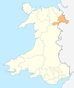
| Principal area | Wrexham |
| Ceremonial county | Wrexham |
| Country | Wales |
| Sovereign state | United Kingdom |
| Post town | WREXHAM |
| Postcode district | LL14 |
| Dialling code | 01691 |
| Police | North Wales |
| Fire | North Wales |
| Ambulance | Welsh |
| EU Parliament | Wales |
| UK Parliament | Clwyd South |
| Welsh Assembly | Clwyd South |
Coordinates: 52°55′49″N 3°03′01″W / 52.93026°N 3.05025°W
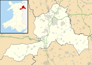
Chirk (Welsh: Y Waun, meaning The Moor[1]) is a small town and local government community, the lowest tier of local government, part of Wrexham County Borough in Wales. In the 2011 census, it had a population of 4,468.[2]
It is situated between Wrexham and Oswestry and has been part of the County Borough since local government reorganisation in 1996. The border with the English county of Shropshire is immediately south of the town, on the other side of the River Ceiriog.
The town is served by Chirk railway station and the A5/A483 roads.
History and heritage
Chirk Castle, a National Trust property, is a medieval castle. Two families are associated with the town and its castle, the Trevor family of Brynkinallt and the Myddletons. The Hughes of Gwerclas, a family descended from the ancient kings of Powys, also dwelt in the area for many years.
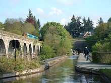
Attractions in the town apart from Chirk Castle include a section of Offa's Dyke and the Chirk Aqueduct on the Llangollen Canal, built in 1801 by Thomas Telford. The Glyn Valley Tramway operated from here.
The Parish Church of St Mary's is a Grade I listed building. The current church building was begun during the 11th Century by the Normans, although it is believed that an older llan, dedicated to St Tysilio, had existed on the site. Indeed, the current church was known by the dedication of St Tysilio until the late 15th or early 16th century, after which it was re-dedicated to St Mary. Today, the church is a member of the Open Church Network and participates in the Sacred Space Project.
Chirk was formerly a coal mining community with coal being worked since the 17th century. The largest of these collieries were Black Park (one of the oldest in the north of Wales) and Brynkinallt (Welsh: Bryncunallt). These coal mines has now also closed.
Chirk was a coaching stop on the old Mail coach route along the A5 from London to Holyhead.
The Chester to Ruabon railway had been extended south to Shrewsbury by 1848 with stations at Llangollen Road (at Whitehurst) and Chirk. South of the town a railway viaduct was constructed by Henry Robertson to take the line over the Ceiriog Valley.
The Llangollen branch of the Shropshire Union Canal runs through Chirk. The canal crosses the Ceiriog Valley (from England into Wales) along Thomas Telford's aqueduct. Telford's aqueduct runs alongside the Robertson' viaduct before the canal enters the Chirk Tunnel.
Modern day

The Ceiriog Memorial Institute, in the Ceiriog valley, just west of Chirk, is home to a collection of Welsh cultural memorabilia and was founded in the early 1900s to support the Welsh language, culture and heritage for future generations.
The town's industries are the manufacture of wood-based panels at Kronospan and chocolate manufacture at Cadbury.
In the 2011 census, a total of 3,652 residents (81.7%) have no skills in the Welsh language.[3]
Sport
Chirk is home to Chirk AAA F.C., a football team founded in 1876.
Chirk Golf Club (now defunct) was founded in 1991. The club closed in September 2012.[4]
Notable people
- Stan Davies, Welsh international footballer
- Peter Edwards, artist
- William Egan, Welsh international footballer
- Edwin Hill-Trevor, 1st Baron Trevor, Member of Parliament (estate based in Chirk)
- John Hulme, cricket player
- Di Jones, Welsh international footballer (resident)
- Lot Jones, Welsh international footballer
- Mike Jones, Welsh international footballer (resident since 1989)
- Paul Jones, Welsh international footballer
- Billy Meredith, Welsh international footballer
- Hugh Morris, Welsh international footballer
- Sir Richard Myddelton, 3rd Baronet, Member of Parliament
- Sir Thomas Myddelton, 1st Baronet, Member of Parliament
- Sir Thomas Myddelton, 2nd Baronet, Member of Parliament
- Robert Myddelton Biddulph, Member of Parliament
- Jack Owen, Welsh international footballer
- George Owen, Welsh international footballer
- Robert Roberts, writer
- Stuart Roberts, footballer for Stoke City F.C.
- Neil Thomas, World Champion athlete
- R. S. Thomas, poet
- Sir Edward Trevor, Member of Parliament
- Horace Viner, footballer for Stoke City F.C.
- Frederick West (1767–1852), Member of Parliament
-

St Mary's Church
-

Baron Trevor of Brynkinallt Mausoleum in churchyard of the Church of St Mary c1905.
-

Medieval sculpture of girl holding a heart.
-

Myddletons family memprial at St Mary's Church
-

Elizabeth Myddleton (Wilbrahim) wife of the 3rd Sir Thomas, 2nd baronet, suckling an infant.
See also
References
- ↑ "Welcome to Chirk and the Ceiriog Valley North Wales". Chirk.com. Retrieved 2013-05-28.
- ↑ "Check Browser Settings". Retrieved 30 September 2014.
- ↑ "Check Browser Settings". Retrieved 30 September 2014.
- ↑ “Chirk Golf Club”, “Golf’s Missing Links”.
- G. G. Lerry, "Collieries of Denbighshire", 1968
External links
- Chirk Town Council website
- BBC Wales - Chirk website
- The Glyn Valley Tramway Trust in Chirk
- St Mary's Church, Chirk
- History of St Marys, Chirk
- Wrexham & Shropshire Railway
| ||||||||||||||||||||||||||||||||||||