Chinchiná, Caldas
| Chinchiná, Caldas | |||
|---|---|---|---|
| Municipality and town | |||
 | |||
| |||
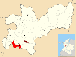 Location of the municipality and town of Chinchiná, Caldas in the Caldas Department of Colombia. | |||
 Chinchiná, Caldas Location in Colombia | |||
| Coordinates: 4°58′57″N 75°36′13″W / 4.98250°N 75.60361°WCoordinates: 4°58′57″N 75°36′13″W / 4.98250°N 75.60361°W | |||
| Country |
| ||
| Department | Caldas Department | ||
| Founded | 1857 | ||
| Government | |||
| • Mayor | Jair Antonio Tabares Chica | ||
| Area | |||
| • Total | 112.4 km2 (43.4 sq mi) | ||
| Elevation | 1,378 m (4,521 ft) | ||
| Population (2012) | |||
| • Total | 47,929 | ||
| • Density | 430/km2 (1,100/sq mi) | ||
| Demonym | Chinchinese | ||
| Time zone | Colombia Standard Time (UTC-5) | ||
| Area code(s) | 57 + 6 | ||
| Website | Official website (Spanish) | ||


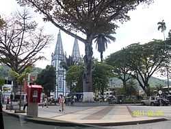
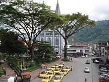
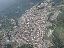
Chinchiná (estimated population 84,000) is a municipality located in the department of Caldas in Colombia, 17 kilometres (11 mi) southwest of Manizales. Chinchiná is rich in character and beautiful landscapes. Founded in 1857 by Antioquian colonists, Chinchiná is settled in a valley surrounded by coffee plantations, called "fincas", in the Central Cordillera of the Andes.
Known as Colombia's coffee heart, the town is home to the Buendía coffee factory and Cenicafé, a coffee research center.
An active volcano, Nevado del Ruiz, lies approximately 30 kilometers (19 mi) to the east.
Chinchiná is situated at 5°0′N 75°35′W / 5.000°N 75.583°W. Its elevation is 1,360 meters (4,462 feet), and has a mean temperature of approximately 20 degrees Celsius.
External links
| Wikimedia Commons has media related to Chinchiná. |
| Wikivoyage has a travel guide for Chinchiná. |
| ||||||||