Chimaltenango
| Chimaltenango | ||
|---|---|---|
|
Chimaltenango | ||
| ||
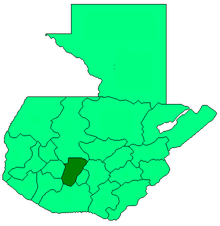
 Chimaltenango Location in Guatemala | ||
| Coordinates: 14°39′44″N 90°49′15″W / 14.66222°N 90.82083°WCoordinates: 14°39′44″N 90°49′15″W / 14.66222°N 90.82083°W | ||
| Country |
| |
| Department |
| |
| Population (2002) | ||
| • Total | 43,900 | |
| Climate | Cwb | |
Chimaltenango is a town in Guatemala of some 43,900 people (as of 2002). It serves as both the capital of the department of Chimaltenango and the municipal seat for the surrounding municipality of the same name. Chimaltenango stands some 35 miles west of Guatemala City, on the Pan-American Highway.
In Pre-Columbian times what is now the city of Chimaltenango was known as B'oko' . Like many other cities in the area, the Spanish Conquistadores used the name given by their Nahuatl speaking allies from central Mexico. The Nahuatl name was Chimaltenanco, or Shield-Town.
The city produces textiles and pottery. It is also the home of the Rose Education Foundation, a non-profit organization working to make educational opportunities available to children living in rural areas in Guatemala.
Sports
América de Chimaltenango football club has played the 2009/2010 season in Guatemala's second division. They play their home games in the Estadio Municipal de Chimaltenango.
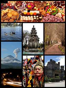
| Wikimedia Commons has media related to Chimaltenango. |
References
- CHIMALTENANGO from Guatemala.
External links
- CHIMALTENANGO from Guatemala.
- Monografia del municipio de Chimaltenango, Dirección Departamental de Educación de Chimaltenango (Spanish)
| |||||||||||||