Chiles (volcano)
| Chiles | |
|---|---|
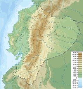
 Chiles Location of Chiles, Colombia/Ecuador | |
| Elevation | 4,723 m (15,495 ft)[1] |
| Location | |
| Location | Carchi, Ecuador |
| Range | Cordillera Real, Andes |
| Coordinates | 0°49′16″N 77°56′6″W / 0.82111°N 77.93500°WCoordinates: 0°49′16″N 77°56′6″W / 0.82111°N 77.93500°W[1] |
| Geology | |
| Type | Stratovolcano |
| Age of rock | Pleistocene |
| Volcanic belt | Northern Volcanic Zone, Andean Volcanic Belt |
| Last eruption | July 17, 1936(?)[1] |
| Climbing | |
| Easiest route | Ecuador side - Class 3 scramble |
Chiles is a volcano on the border of Colombia and Ecuador. It lies 3 kilometres (2 mi) south-east of the volcano Cerro Negro de Mayasquer, and the two peaks are considered part of the same Chiles-Cerro Negro volcanic complex. A 1936 eruption reported by the Colombian government agency Ingeominas may have been from the Ecuadorean volcano Reventador, otherwise the volcano has not erupted for around 160,000 years.[1]
On 20 October 2014 Servicio Geológico Colombiano (SGC) reported that a M 5.8 earthquake, the largest to date, occurred in the vicinity of the Cerro Negro de Mayasquer and Chiles volcanoes at a depth of less than 10 km. The event was felt to the N in Pasto (Colombia) and to the S in Quito (Ecuador). On 21 October 2014 SGC raised the Alert Level for the volcanic complex to Orange (level 3 of 4) noting that a seismic swarm characterized by 4,300 earthquakes was detected in an 18-hour period. Hypocenters were located 1-4 km SW of Chiles volcano at depths of 3-5 km and local magnitudes between M 0.2 and 4.5. Inhabitants felt 11 of the events. On 22 October a report noted that the total number of earthquakes recorded on 21 October 2014 reached 7,717, which was the largest number of earthquakes recorded on one day since the installation of a local seismic network in November 2013. Several swarms have occurred in the area since February 2013. By the end of November 2014 over 132,000 earthquakes occurred within a narrow area .5 - 6 km SW of the summit of Chiles.
See also
References
- ↑ 1.0 1.1 1.2 1.3 "Cerro Negro de Mayasquer: Synonyms & Subfeatures". Global Volcanism Program. Smithsonian Institution. Retrieved May 2, 2011.