Chic-Choc Mountains
| Chic-Choc Mountains | |
|---|---|
 | |
| Highest point | |
| Peak | Mont Jacques-Cartier |
| Elevation | 1,268 m (4,160 ft) |
| Coordinates | 48°59′26″N 65°56′33″W / 48.99056°N 65.94250°W |
| Dimensions | |
| Length | 95 km (59 mi) East-West |
| Width | 10 km (6.2 mi) |
| Geography | |
|
<div style="padding:2px 2px 2px 2px;>  | |
| Country | Canada |
| State/Province | Quebec |
| Range coordinates | 48°55′N 66°00′W / 48.92°N 66°WCoordinates: 48°55′N 66°00′W / 48.92°N 66°W |
| Parent range | Notre Dame Mountains |
The Chic-Choc Mountains, also spelled Shick Shocks, is a mountain range in the central region of the Gaspé Peninsula in Quebec, Canada. It is a part of the Notre Dame Mountains, which is a continuation of the Appalachian Mountains.[1]
History
The name Chic-Chocs comes from the Mi'kmaq word sigsôg, meaning "crags" or "rocky mountains." It has undergone many different spellings over time, including Chikchâks (1836), Shick-shock (1857), and Chick-Saws (1863).[1]
Geography
The Chic-Chocs run parallel to the St. Lawrence River and are located some 20 to 40 kilometers inland. They are a narrow band of mountains approximately 95 kilometres (59 mi) long and 10 kilometres (6.2 mi) wide.[1] The Chic-Chocs are heavily eroded, with rounded, flattened tops and steep sides. Over 25 mountains in the range have peaks higher than 1,000 metres (3,300 ft); the highest is Mont Jacques-Cartier at 1,268 metres (4,160 ft). Caribou can be found in the plateaus of this region.
Tourism
Although visited by just a few tourists, Chic-Choc Mountains became much more popular in the late 1990s as backcountry skiing gained popularity in Eastern Canada.
A network of trails, including the International Appalachian Trail, passes through these mountains. Quebec's Parc national de la Gaspésie protects most of the mountain range.
-
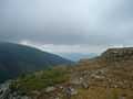
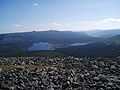
View from Mont Jacques-Cartier.
-
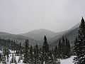
Winter in the Chic Choc Mountains
-
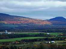
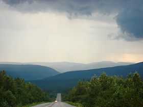
Near Sayabec
-
Parc de la Gaspésie
References
- ↑ 1.0 1.1 1.2 "Monts Chic-Chocs". Banque de noms de lieux du Québec (in French). Commission de Toponymie. Retrieved 1 Feb 2011.