Chiantla
| Chiantla | |
|---|---|
| Municipality | |
|
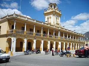
Municipal palace of Chiantla | |
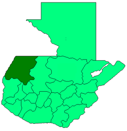
 Chiantla Location in Guatemala | |
| Coordinates: 15°21′0″N 91°27′0″W / 15.35000°N 91.45000°W | |
| Country |
|
| Department |
|
| Municipality | Chiantla |
| Government | |
| • Type | Municipal |
| Area | |
| • Municipality | 536 km2 (207 sq mi) |
| Elevation | 2,000 m (7,000 ft) |
| Highest elevation | 3,800 m (12,500 ft) |
| Lowest elevation | 1,900 m (6,200 ft) |
| Population (Census 2002)[1] | |
| • Municipality | 74,978 |
| • Urban | 7,737 |
| • Ethnicities | Ladino, Mam |
| • Religions | Roman Catholicism, Evangelicalism, Maya |
| Climate | Cwb |
| Website | http://www.inforpressca.com/chiantla/ |
Chiantla (Spanish pronunciation: [ˈtʃjantla]) is a municipality in the Guatemalan department of Huehuetenango. It is situated at 2,000m above sea level. It covers a terrain of 536km2. The annual festival is on January 28.
Geography
The city of Chiantla is located within the Northwest sector of the department of Huehuetenango. It sits in the mountainside above the city of Huehuetenango, approximately 2 hours from the Mexican border.
Climate
At an altitude of approximately 2000m, Chiantla has a climate similar to that of Antigua, though with the extra 600m above sea level it is often a little chillier in the night. The rainy season is from May to October, with mornings starting out warm and humid, followed by heavy rains - and even hail - in the afternoons, which usually dissipate by evening.
Population
The inhabitants of the city are mostly ladino, it is common to hear the languages of Popti, Canjobal, Chuj, and Mam being spoken by street venders, shoppers and residents.
Economy
Mining
Lead production was noted in the area in 1850.[2] Modern exploration of the Chiantla mining district by Firestone Ventures, a Canadian firm headquartered in Edmonton, has produced a promising prospect for a lead,zinc,silver open pit mine at its Torlon Hill Zinc-Lead-Silver Project west of Chiantla at the site of the Cinco Hermanos workings.[3]
References
- ↑ "XI Censo Nacional de Poblacion y VI de Habitación (Censo 2002)". INE. 2002.
- ↑ Baily, John (1850). Central America; Describing Each of the States of Guatemala, Honduras, Salvador, Nicaragua, and Costa Rica. London: Trelawney Saunders. p. 85.
- ↑ "FIRESTONE VENTURES IN GUATEMALA" (PDF). www.firestoneventures.com. Firestone Ventures, Inc. February 2011. Retrieved January 29, 2015.
External links
- Site of Chiantla Spanish
- Map showing relationship of Chiantla to the Pan American Highway and the Torlon Hill zinc project