Chezelle
| Chezelle | ||
|---|---|---|
|
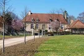
Chateau Montchoisy | ||
| ||
 Chezelle | ||
|
Location within Auvergne region  Chezelle | ||
| Coordinates: 46°13′08″N 3°07′27″E / 46.2189°N 3.1242°ECoordinates: 46°13′08″N 3°07′27″E / 46.2189°N 3.1242°E | ||
| Country | France | |
| Region | Auvergne | |
| Department | Allier | |
| Arrondissement | Moulins | |
| Canton | Chantelle | |
| Intercommunality | Sioule, Colettes et Bouble | |
| Government | ||
| • Mayor (2008–2014) | Alain Mélon | |
| Area1 | 7.33 km2 (2.83 sq mi) | |
| Population (2008)2 | 162 | |
| • Density | 22/km2 (57/sq mi) | |
| INSEE/Postal code | 03075 / 03140 | |
| Elevation |
287–344 m (942–1,129 ft) (avg. 289 m or 948 ft) | |
|
1 French Land Register data, which excludes lakes, ponds, glaciers > 1 km² (0.386 sq mi or 247 acres) and river estuaries. 2 Population without double counting: residents of multiple communes (e.g., students and military personnel) only counted once. | ||
.svg.png)
Chezelle is a commune in the Allier department in central France.
Population
| Historical population | ||
|---|---|---|
| Year | Pop. | ±% |
| 1962 | 133 | — |
| 1968 | 163 | +22.6% |
| 1975 | 148 | −9.2% |
| 1982 | 109 | −26.4% |
| 1990 | 122 | +11.9% |
| 1999 | 142 | +16.4% |
| 2008 | 162 | +14.1% |
See also
References
| Wikimedia Commons has media related to Chezelle. |