Cherbourg-Octeville
| Cherbourg-Octeville | ||
|---|---|---|
| ||
 Cherbourg-Octeville | ||
|
Location within Lower Normandy region  Cherbourg-Octeville | ||
| Coordinates: 49°38′N 1°37′W / 49.63°N 1.62°WCoordinates: 49°38′N 1°37′W / 49.63°N 1.62°W | ||
| Country | France | |
| Region | Lower Normandy | |
| Department | Manche | |
| Arrondissement | Cherbourg | |
| Intercommunality | Cherbourg | |
| Government | ||
| • Mayor | Bernard Cazeneuve | |
| Area1 | 14.26 km2 (5.51 sq mi) | |
| Population (1999)2 | 42,318 | |
| • Density | 3,000/km2 (7,700/sq mi) | |
| INSEE/Postal code | 50129 / 50100, 50130 | |
|
1 French Land Register data, which excludes lakes, ponds, glaciers > 1 km² (0.386 sq mi or 247 acres) and river estuaries. 2 Population without double counting: residents of multiple communes (e.g., students and military personnel) only counted once. | ||
Cherbourg-Octeville (French pronunciation: [ʃɛʁ.buʁ ɔk.tə.vil]) is a city and commune, situated on the Cotentin peninsula in the Manche department of Lower Normandy in north-western France. It is a subprefecture of its department, and was officially formed when the commune of Cherbourg absorbed Octeville on 28 February 2000. Due to its union, it is the most populated city in its department and the second-most in the region after the prefecture, Caen.
Cherbourg holds an arsenal of the French Navy. It is also a ferryport, with lines to the English ports of Poole and Portsmouth, the Irish port of Rosslare Harbour and St Helier on Jersey.
Geography
Cherbourg-Octeville is located at the northern tip of the Cotentin Peninsula, in the department of Manche, of which it is a subprefecture. At the time of the 1999 census the city of Cherbourg had an area of 6.91 square kilometres (2.668 sq mi), while the city of Octeville had an area of 7.35 km2 (2.838 sq mi). The amalgamated city today has an area of 14.26 km2 (5.506 sq mi).
Climate
| Climate data for Cherbourg (Gonneville) | |||||||||||||
|---|---|---|---|---|---|---|---|---|---|---|---|---|---|
| Month | Jan | Feb | Mar | Apr | May | Jun | Jul | Aug | Sep | Oct | Nov | Dec | Year |
| Average high °C (°F) | 7.8 (46) |
7.8 (46) |
9.9 (49.8) |
11.8 (53.2) |
14.9 (58.8) |
17.7 (63.9) |
19.8 (67.6) |
19.9 (67.8) |
18.0 (64.4) |
14.8 (58.6) |
11.0 (51.8) |
8.5 (47.3) |
13.49 (56.27) |
| Average low °C (°F) | 3.5 (38.3) |
3.2 (37.8) |
4.6 (40.3) |
5.7 (42.3) |
8.5 (47.3) |
10.9 (51.6) |
13.0 (55.4) |
13.3 (55.9) |
11.8 (53.2) |
9.4 (48.9) |
6.4 (43.5) |
4.2 (39.6) |
7.88 (46.18) |
| Average precipitation mm (inches) | 100.8 (3.969) |
69.6 (2.74) |
69.8 (2.748) |
61.8 (2.433) |
58.1 (2.287) |
49.1 (1.933) |
46.4 (1.827) |
51.4 (2.024) |
74.4 (2.929) |
111.6 (4.394) |
113.1 (4.453) |
113.6 (4.472) |
919.7 (36.209) |
| Source: Météo-France | |||||||||||||
Demographics
The combined population of Cherbourg and Octeville at the 1999 census was 42,318 inhabitants. (Separately, the official numbers were 25,370 for Cherbourg and 16,948 for Octeville.) The population of Cherbourg metropolitan area (the aire urbaine de Cherbourg) at the 1999 census was 117,855 inhabitants. The city is now the second largest in the Basse-Normandie region (after Caen), surpassing Alençon, which had been second before the amalgamation. Also, the city is the largest in the Manche département, although Saint-Lô is the préfecture (capital).
History
Cherbourg-Octeville
The Cotentin Peninsula was the first territory conquered by the Vikings in their 9th-century invasion. They developed Cherbourg as a port. The Germanic-sounding name of the city comes from Old English Ċiriċeburh ("village of the church") and was coined during the Migration Period.[1]
During the Seven Years' War, the British briefly occupied the town after the Raid on Cherbourg in 1758. The British destroyed military buildings and warehouses before departing.
In the Napoleonic era, the harbour was fortified to prevent British naval incursions. Underwater obstructions were sunk at intervals across the harbour entrance, and progressively replaced with piles of masonried rubble. The works were begun in 1784 and were not concluded until 1850, long after Napoleon's defeat at the Battle of Waterloo.
On 19 June 1864, the Battle of Cherbourg, a naval engagement between USS Kearsarge and CSS Alabama that was part of the American Civil War, took place in international waters off Cherbourg. The Alabama was hit and sank. In November 1984, the French Navy mine hunter Circé discovered a wreck under nearly 60 m (200 ft) of water off Cherbourg. The location of the wreck (WGS84) was 49°45'147N / 001°41'708W. Captain Max Guerout later confirmed the wreck to be of the Alabama.
On 31 July 1909, tsar Nicholas II and French president Armand Fallières met officially in Cherbourg to reinforce the Franco-Russian Alliance.
On 10 April 1912, the doomed ocean liner RMS Titanic made its first stop in Cherbourg after it left Southampton, England.[2]
During World War II, the Germans occupied the north of France and fortified the coastline against invasion. As a deep-water port, Cherbourg was of strategic importance, very heavily protected against seaborne assault. The Battle of Cherbourg, fought by the Allies in June 1944 against the Germans following the Normandy Invasion, ended with the Allies capturing the city and its vital port on 30 June.
The Norman language writer Alfred Rossel, a native of Cherbourg, composed many songs which form part of the heritage of the region. Rossel's song "Sus la mér" ("on the sea") is often sung as a regional patriotic song. The local dialect is known as Cotentinais.
Periphery
La Glacerie was named for glass factory. In 1655, Louis Lucas de Néhou built a glass factory which produced windows and mirrors for such buildings as the Galerie des Glaces and Château de Versailles. The factory in La Glacerie was destroyed by Allied bombardments in 1944 during the Normandy invasion.
Heraldry
.svg.png) |
The arms of Cherbourg-Octeville are blazoned : Azure, on a fess argent between 3 bezants (Or), 3 mullets of 6 points sable. |
Main sights
- The Cité de la Mer is a large museum devoted to scientific and historical aspects of maritime subjects.
- Cherbourg Basilica
- La Glacerie has a race track.
- Jardin botanique de la Roche Fauconnière, a private botanical garden.
- The Musée de la Libération is dedicated to Second World War History.
- The Musée des beaux-arts Thomas Henry has a collection of over 300 paintings, founded on the original collection of Cherbourg native, Thomas Henry.
- The Museum Emmanuel-Liais is a museum devoted to natural history, archaeology and ethnography.
- Le Trident theatre
Representation in other media
- Ken Follett's novel The Pillars of the Earth features Cherbourg as the hometown of Jacques Cherbourg, a Frenchman washed ashore in England during the European Middle Ages. His son, Jack Jackson, travels to France as an adult and meets his father's family in Cherbourg.
- Cherbourg is the setting of the film The Umbrellas of Cherbourg, directed by Jacques Demy. Madame Emery and her 17-year-old daughter Geneviève (Catherine Deneuve) sell umbrellas at their tiny boutique.
- Cherbourg was the first site outside the United States to be designated as an American Civil War Heritage Site by the Civil War Preservation Trust, because a sea battle was fought nearby in 1864 by Union and Confederate warships. See the Battle of Cherbourg (1864).
- Kimberly Brubaker Bradley set her novel, For Freedom: The Story of a French Spy in Cherbourg. The narrator, Suzanne Hall (née David), is a spy for the French Resistance.
- Cherbourg (or to be precise its analog in the Lord Darcy universe) is the setting for Randall Garrett's short story "A Case of Identity" and is part of the backdrop for his novel Too Many Magicians.
Public transport and infrastructure
Road
Cherbourg is at the end of the N13 road from Paris and Caen.
Bus
City buses are run by Zephir.
Rail
The city's station is at the end of a railway line built by the Chemins de Fer de l'Ouest from Paris. Regular services operate to Paris-Saint-Lazare via Caen using Corail Intercites stock, local TER services operate from the station to Lisieux via Caen and to Rennes via Saint-Lô. As well as a main line station there was also the Gare Maritime Transatlantique station. This now forms part of the Cité de la mer.
Sea
Cherbourg-Octeville is a port on the English Channel with a number of regular passenger and freight ferry services operating from the large modern ferry terminal and has a major artificial harbour. The following operators currently run services from the port:
- Brittany Ferries to Poole (1 sailings daily) and Portsmouth (up to 2 sailings daily, summer only).
- Stena Line to Rosslare (3 sailings weekly).
- Irish Ferries to Rosslare (3 sailings weekly) and Dublin (1 sailing weekly).
- Condor Ferries to Portsmouth (1 sailing weekly in summer only).
Cherbourg-Octeville has previously had services operated by the following operators:
- Stena Line to Southampton (up to 2 sailings daily). Withdrawn in 1996.
- P&O Ferries to Portsmouth (up to 2 sailings daily by conventional ferry and up to 3 by fast ferry during the summer). Withdrawn in 2005 following a business review.
- P&O Irish Sea to Rosslare (up to 3 sailings weekly) and Dublin (weekends only during the summer). Dublin service withdrawn in 2004 and Rosslare service sold to Celtic Link.
- HD Ferries to Guernsey and Jersey. Operated in 2007 but cancelled in 2008 due to lack of customers.
- Celtic Link Ferries to Rosslare (3 sailings weekly). Service sold to Stena Line.
It should be mentioned that Brittany Ferries to Poole briefly stopped their conventional ferry service in early 2010 but resumed it in February 2011.
In addition to ferry services, the port also handles cruise ships at the Gare Maritime Transatlantique on the Quai de France next to the Cité de la mer and conventional cargo ships in the eastern area of the docks on the Quai des Flamands and Quai des Mielles.
Air
The nearest airport is in Maupertus-sur-Mer which is named Cherbourg Maupertus.
International relations
Twin towns – Sister cities
Gallery
-

Town centre
-

Charles de Gaulle delivering a speech in liberated Cherbourg from the Hôtel de ville (townhall)
-
.JPG)
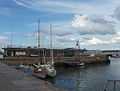
Haven
-

Napoléon and Marie Louise attending the parade of the squadron in Cherbourg in 1811
-
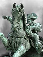
Statue of Napoléon
-

View from Commerce basin
-

Cherbourg roadstead
-

17th century Cherbourg
-
.jpg)
Port in 1933
-

The battle for Cherbourg (WWII)
-

French nuclear submarine Le Redoutable
-

Current view of the city
-

Rue des Fossés
-

Quartiers (suburbs) de l'Amont Quentin et des Provinces
-
-

Arsenal hangars
-

Prison
-

Faculty of Engineering
-

l'Hôpital Louis-Pasteur
-

Le Vox, Avenue de Paris. Former cinema, turned into Hall.
-

Theatre
-

Transatlantic Station
-

Commerce basin
-

Hôtel Atlantique
-

Cherbourg Fort, western wall
-

Basilique Sainte-Trinité
-

Notre-Dame du Vœu Church

See also
- Les Parapluies de Cherbourg (The Umbrellas of Cherbourg), a musical film
- Cité de la Mer
- Battle of Cherbourg, 1944
References
- ↑ François de Beaurepaire, Les noms des communes et anciennes paroisses de la Manche, éditions Picard 1986.
- ↑ http://history1900s.about.com/od/1910s/a/titanictimeline.htm
- ↑ 3.0 3.1 3.2 3.3 3.4 "National Commission for Decentralised cooperation". Délégation pour l’Action Extérieure des Collectivités Territoriales (Ministère des Affaires étrangères) (in French). Retrieved 2013-12-26.
- ↑ "British towns twinned with French towns". Archant Community Media Ltd. Retrieved 2013-07-11.
- ↑ "Twinning". Borough of Poole. 2008. Retrieved 2012-12-05.
Further reading
- Published in the 19th century
- "Cherbourg", A Handbook for Travellers in France, London: John Murray, 1861
- C.B. Black (1876), "Cherbourg", Guide to the North of France, Edinburgh: Adam and Charles Black
- "Cherbourg", Northern France, Leipsic: Karl Baedeker, 1899, OCLC 2229516
- Published in the 20th century
- "Cherbourg", The Encyclopaedia Britannica (11th ed.), New York: Encyclopaedia Britannica, 1910, OCLC 14782424
External links
| Wikimedia Commons has media related to Cherbourg. |
- Cherbourg on Titanic-Titanic.com
- Official website (English/French/German)
- Visit of Queen Victoria to Cherbourg Visit of Queen Victoria