Cheffes
| Cheffes | |
|---|---|
 | |
 Cheffes | |
|
Location within Pays de la Loire region  Cheffes | |
| Coordinates: 47°37′18″N 0°30′23″W / 47.6217°N 0.5064°WCoordinates: 47°37′18″N 0°30′23″W / 47.6217°N 0.5064°W | |
| Country | France |
| Region | Pays de la Loire |
| Department | Maine-et-Loire |
| Arrondissement | Angers |
| Canton | Tiercé |
| Intercommunality |
C.C. de Loir-et-Sarthe Pays des Vallées d'Anjou |
| Government | |
| • Mayor (2008–2014) | Christian Ancelle |
| Area1 | 17.35 km2 (6.70 sq mi) |
| Population (2006)2 | 879 |
| • Density | 51/km2 (130/sq mi) |
| INSEE/Postal code | 49090 / 49125 |
| Elevation |
14–53 m (46–174 ft) (avg. 21 m or 69 ft) |
|
1 French Land Register data, which excludes lakes, ponds, glaciers > 1 km² (0.386 sq mi or 247 acres) and river estuaries. 2 Population without double counting: residents of multiple communes (e.g., students and military personnel) only counted once. | |
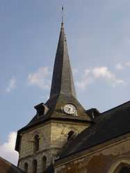
Cheffes is a commune in the Maine-et-Loire department of western France.
See also
References
External links
| Wikimedia Commons has media related to Cheffes. |