Chavanat
| Chavanat | |
|---|---|
|
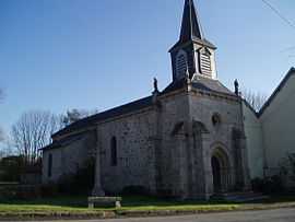
The church in Chavanat | |
 Chavanat | |
|
Location within Limousin region  Chavanat | |
| Coordinates: 45°57′13″N 1°57′54″E / 45.9536°N 1.965°ECoordinates: 45°57′13″N 1°57′54″E / 45.9536°N 1.965°E | |
| Country | France |
| Region | Limousin |
| Department | Creuse |
| Arrondissement | Aubusson |
| Canton | Saint-Sulpice-les-Champs |
| Intercommunality | Pays Creuse-Thaurion-Gartempe |
| Government | |
| • Mayor (2008–2014) | Guy Desloges |
| Area1 | 12.73 km2 (4.92 sq mi) |
| Population (2008)2 | 130 |
| • Density | 10/km2 (26/sq mi) |
| INSEE/Postal code | 23060 / 23250 |
| Elevation |
471–647 m (1,545–2,123 ft) (avg. 500 m or 1,600 ft) |
|
1 French Land Register data, which excludes lakes, ponds, glaciers > 1 km² (0.386 sq mi or 247 acres) and river estuaries. 2 Population without double counting: residents of multiple communes (e.g., students and military personnel) only counted once. | |
Chavanat (Occitan: Chavanac) is a commune in the Creuse department in the Limousin region in central France.
Geography
An area of forestry and farming comprising the village and several hamlets, situated in the valley of the river Thaurion, some 8 miles (13 km) west of Aubusson at the junctions of the D3, D10 and the D941 roads.
Population
| Historical population | ||
|---|---|---|
| Year | Pop. | ±% |
| 1962 | 140 | — |
| 1968 | 182 | +30.0% |
| 1975 | 202 | +11.0% |
| 1982 | 154 | −23.8% |
| 1990 | 144 | −6.5% |
| 1999 | 127 | −11.8% |
| 2008 | 130 | +2.4% |
Sights
- The church, dating from the thirteenth century.
See also
References
External links
- Chavanat on the Quid website (French)
| Wikimedia Commons has media related to Chavanat. |