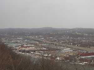
Chateau (Pittsburgh)
| Chateau | |
|---|---|
| Neighborhood of Pittsburgh | |
|
Chateau is the swathe of large warehouses and other industrial facilities between the Ohio River and Route 65. | |
 | |
| Coordinates: 40°26′57″N 80°01′42″W / 40.4493°N 80.0283°W | |
| Country | United States |
| State | Pennsylvania |
| County | Allegheny County |
| City | Pittsburgh |
| Area[1] | |
| • Total | 0.383 sq mi (0.99 km2) |
| Population (2000)[1] | |
| • Total | 39 |
| • Density | 100/sq mi (39/km2) |
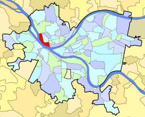
Chateau is a neighborhood in Pittsburgh, Pennsylvania's north city area. It has a zip code of 15233, and has representation on Pittsburgh City Council by the council member for District 6 (North Shore/Downtown Neighborhoods).[2] It is on the banks of the Ohio River and is separated from the neighborhood of Manchester by PA Route 65.
As of the 2000 U.S. Census, Chateau has a population of 39. A 2006 investigation by the Pittsburgh Post-Gazette found the neighborhood virtually uninhabited.[3] This may be because the neighborhood mostly consists of warehouses and places of business along the Ohio River.
In August 2009, the Rivers Casino opened along the Ohio River in the Chateau neighborhood. The Carnegie Science Center and the Manchester Craftsmen's Guild are also located in Chateau.
Surrounding and adjacent Pittsburgh neighborhoods
Allegheny West, Manchester, Marshall-Shadeland, North Shore, West End Valley (via West End Bridge)
See also
References
- ↑ 1.0 1.1 "Census: Pittsburgh" (PDF). Pittsburgh Department of City Planning. January 2006. Retrieved 2007-07-19.
- ↑ Toker, Franklin (1994) [1986]. Pittsburgh: An Urban Portrait. Pittsburgh: University of Pittsburgh Press. ISBN 0-8229-5434-6.
- ↑ Pittsburgh Post-Gazette. "New casino had no 'not in my back yard' problem in Chateau; there are no back yards." Dec. 28, 2006
Gallery
-
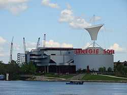
Carnegie Science Center, opened in 1991, at 1 Allegheny Avenue in the Chateau neighborhood of Pittsburgh, Pennsylvania.
-
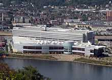
Rivers Casino, opened in 2009, at 777 Casino Drive.
-
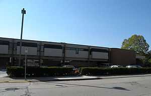
Manchester Craftsmen's Guild, founded in 1968, at 1815 Metropolitan Street.
-
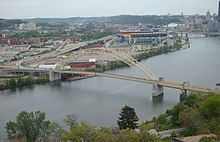
West End Bridge, built from 1930 to 1932, crosses the Ohio River and connects the West End to the Chateau neighborhood in the North Side of the city.
External links
| Wikimedia Commons has media related to Chateau (Pittsburgh). |
