Chat Trakan District
| Chat Trakan ชาติตระการ | |
|---|---|
| Amphoe | |
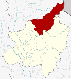 Amphoe location in Phitsanulok Province | |
| Coordinates: 17°16′36″N 100°35′57″E / 17.27667°N 100.59917°ECoordinates: 17°16′36″N 100°35′57″E / 17.27667°N 100.59917°E | |
| Country |
|
| Province | Phitsanulok |
| Seat | Pa Daeng |
| Area | |
| • Total | 1,586.2 km2 (612.4 sq mi) |
| Population (2005) | |
| • Total | 38,646 |
| • Density | 24.4/km2 (63/sq mi) |
| Time zone | THA (UTC+7) |
| Postal code | 65170 |
| Geocode | 6503 |
Chat Trakan (Thai: ชาติตระการ) is the northernmost district (amphoe) of Phitsanulok Province, northern Thailand.
History
Mueang Chat Trakan was an ancient city in the same age as Mueang Nakhon Thai. Originally part of Nakhon Thai district, it was made a minor district (King Amphoe) on May 1, 1969,consisting of the two tambon Chat Trakan and Pa Daeng.[1] It was upgraded to a full district on April 1, 1974.[2] It was a scene of conflict in the Thai–Laotian Border War (December 1987 – February 1988.)
Geography
Neighboring districts are (from the southeast clockwise) Na Haeo of Loei Province, Nakhon Thai, Wang Thong, Wat Bot of Phitsanulok Province, Thong Saen Khan and Nam Pat of Uttaradit Province. And to the east it borders Xaignabouli of Laos.
Chat Trakan lies within the Nan Basin, which is part of the Chao Phraya Watershed. The Khwae Noi River flows through Chat Trakan, as well as the lesser Kap (Thai: ลำน้ำคับ), Phak (Thai: ลำน้ำภาค) and Kleung (Thai: ลำน้ำคลึง) Rivers.
The Namtok Chat Trakan National Park is located in Chat Trakan district. The northeastern part of the district is located in the southernmost prolongation of the Luang Prabang Range mountain area of the Thai highlands.[3]
Administration
The district is subdivided into 6 subdistricts (tambon), which are further subdivided into 72 villages (muban). The township (thesaban tambon) Pa Daeng covers parts of tambon Pa Daeng and Tha Sakae. There are further 6 Tambon administrative organizations (TAO).
| No. | Name | Thai name | Villages | Inh. | |
|---|---|---|---|---|---|
| 1. | Pa Daeng | ป่าแดง | 12 | 7,774 | |
| 2. | Chat Trakan | ชาติตระการ | 9 | 4,608 | |
| 3. | Suan Miang | สวนเมี่ยง | 10 | 5,559 | |
| 4. | Ban Dong | บ้านดง | 10 | 7,809 | |
| 5. | Bo Phak | บ่อภาค | 16 | 7,751 | |
| 6. | Tha Sakae | ท่าสะแก | 15 | 5,145 |
Temples
There are 36 active Buddhist temples in Amphoe Chat Trakan.[4]
References
- ↑ ประกาศกระทรวงมหาดไทย เรื่อง แบ่งท้องที่ตั้งเป็นกิ่งอำเภอ. Royal Gazette (in Thai) 86 (42 ง): 1696. May 13, 1969.
- ↑ พระราชกฤษฎีกาตั้งอำเภอเขาวง อำเภอเชียงม่วน อำเภอดอนตาล อำเภอชาติตระการ อำเภอภูเรือ อำเภอเคียนซา อำเภอน้ำโสม อำเภอหนองวัวซอ และอำเภอน้ำยืน พ.ศ. ๒๕๑๗. Royal Gazette (in Thai) 91 (54 ก special issue): 30–33. March 28, 1974.
- ↑ ดร.กระมล ทองธรรมชาติ และคณะ, สังคมศึกษา ศาสนาและวัฒนธรรม ม.1, สำนักพิมพ์ อักษรเจริญทัศน์ อจท. จำกัด, 2548, หน้า 24-25
- ↑ Culture.Pitlok.net
External links
| ||||||