Chapeau, Allier
| Chapeau | |
|---|---|
|
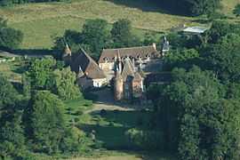
Chateau | |
 Chapeau | |
|
Location within Auvergne region  Chapeau | |
| Coordinates: 46°29′19″N 3°31′26″E / 46.4886°N 3.5239°ECoordinates: 46°29′19″N 3°31′26″E / 46.4886°N 3.5239°E | |
| Country | France |
| Region | Auvergne |
| Department | Allier |
| Arrondissement | Moulins |
| Canton | Neuilly-le-Réal |
| Intercommunality | Moulins |
| Government | |
| • Mayor (2008–2014) | Pierre Brenon |
| Area1 | 33.42 km2 (12.90 sq mi) |
| Population (2008)2 | 223 |
| • Density | 6.7/km2 (17/sq mi) |
| INSEE/Postal code | 03054 / 03340 |
| Elevation |
239–285 m (784–935 ft) (avg. 256 m or 840 ft) |
|
1 French Land Register data, which excludes lakes, ponds, glaciers > 1 km² (0.386 sq mi or 247 acres) and river estuaries. 2 Population without double counting: residents of multiple communes (e.g., students and military personnel) only counted once. | |
Chapeau is a commune in the Allier department in central France.
Population
| Historical population | ||
|---|---|---|
| Year | Pop. | ±% |
| 1962 | 294 | — |
| 1968 | 329 | +11.9% |
| 1975 | 295 | −10.3% |
| 1982 | 300 | +1.7% |
| 1990 | 264 | −12.0% |
| 1999 | 216 | −18.2% |
| 2008 | 223 | +3.2% |
See also
References
| Wikimedia Commons has media related to Chapeau. |