Champlain River
| Champlain River | |
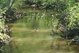 Champlain River in Trois-Rivières (Sector Saint-Louis-de-France) | |
| Country | |
|---|---|
| Province | |
| Region | Mauricie |
| Source | |
| - elevation | 130 m (427 ft) |
| Mouth | |
| - location | Champlain, Mauricie administrative region |
| Length | 66.7 km (41 mi) |
The Champlain River is 66.7 km long flowing on the north shore of St. Lawrence river, between Saint-Maurice River and the Batiscan River watershed, in Les Chenaux Regional County Municipality, in administrative region of Mauricie, in the province of Quebec, Canada.
Geography
Champlain River is flowing almost at the boundary between the manors of Batiscan and Champlain. Champlain river flows from north to south to empty in the St. Lawrence river at Champlain village. Champlain River rises at an altitude of about 130 meters[1] in wetlands located at the foot of the moraine of Saint-Narcisse.[2] Its watershed through the municipalities of Notre-Dame-du-Mont-Carmel, Trois-Rivières (Saint-Louis-de-France area), Saint-Maurice, Saint-Narcisse, Saint-Luc-de-Vincennes, Sainte-Geneviève-de-Batiscan, Batiscan and Champlain, all located, with the exception of Trois-Rivières, in the Les Chenaux Regional County Municipality.
Champlain river divides into four distinct branches that connect to the main branch.[2] It is characterized by the presence of several meanders, a number of which are abandoned along the river near its mouth.[3] The geographical coordinates of the mouth of the river are: -72.28194 West, 46.44695 North.
The watershed of the river Champlain is divided into five sub-basins, sub-basins upstream of the four branches of the main section, from west to east, the sub-basins of rivers Champlain (upstream) of burned with bacon and fork, and the sub-basin of the downstream portion of the Champlain River which flows in the four branches.[4] The slope varies from 5.0 m/km in the sub-basin of the "rivière Brulée" (Burned River) to 0.7 m/km in the sub-basin of the river downstream of the Champlain portion.
Toponymy
Samuel de Champlain gave its name to this river. It is reported for the first time on the map in 1613
by Samuel de Champlain, shifted back to his card in 1632. This name, Champlain, was then given to the lordship (1664), the catholic parish (1665), the provincial county (1829), the municipality (1845) and the Federal county (1867).[5]
The toponym "Champlain River" was officialized in the registry of places name at the Commission de toponymie du Québec as of December 5, 1968.
History
In 1863, Stanislas Drapeau Champlain wrote that "Champlain river has enough water power in order to activate flour mills and saws, and the large tannery of Mr. Richardson, living in Quebec".[6]
About 1800, Mathew Bell built a mill having 32 saws. Burned in 1850, it was replaced by a saw mill counting 20 saws and a tannery belonging to L. Osborne Richardson. The tannery was moved to the Eastern Townships in 1875.[7]
See also
- Champlain (disambiguation page)
- Champlain (electoral district) at Federal level
- Champlain (provincial electoral district)
- Champlain, the municipality
- Lordship of Champlain
- Saint-Luc-de-Vincennes
- Saint-Narcisse
- St. Lawrence River
Notes and references
- ↑ William Tellier, Mylène Valley, Isabelle Lavoie and Stéphane Campeau,Portrait du bassin versant de la rivière Champlain, Rapport déposé au Comité ZIP les Deux-Rive (Portrait of the watershed of the river Champlain, report tabled by Deux-Rives ZIP Committee). Trois-Rivières, Section of Geography, University of Quebec at Trois-Rivières, page 18. (French)
- ↑ 2.0 2.1 William Tellier, Mylène Valley, Isabelle Lavoie and Stéphane Campeau, Portrait du bassin versant de la rivière Champlain, Rapport déposé au Comité ZIP les Deux-Rive (Portrait of the watershed of the river Champlain, report tabled by Deux-Rives ZIP Committee). Trois-Rivières, Section of Geography, University of Quebec at Trois-Rivières, page 9. (French)
- ↑ Jean-Pierre Chartier, "Les caprices d'une rivière" (The vagaries of a river) Le Postillon de Champlain (The Postilion of Champlain), Champlain, Champlain Historical Society, vol. 25, No. 2, March 2005, pp. 10-18 (first part), vol. 26, No. 1, December 2005, pp. 4-11 (second part); flight. 26, No. 2, April 2006, pp. 3-7 (third party); flight. 27, No. 1, December 2006, pp. 14-19 (Part Four) flight. 29, No. 2, April 2009, pp. 8-12 (fifth and last part). (French)
- ↑ William Tellier, Mylène Valley, Isabelle Lavoie and Stéphane Campeau, Portrait du bassin versant de la rivière Champlain, Rapport déposé au Comité ZIP les Deux-Rives (Basin side portrait of the Champlain River, Report submitted to the ZIP Committee Deux-Rives). Trois-Rivières, Section of Geography, University of Quebec at Trois-Rivières, page 11. (French)
- ↑ René Beaudoin, "375e anniversaire du nom de Champlain" (375th anniversary of Champlain's name), The Postilion de Champlain, Champlain, Champlain historical Society, vol. 27, No. 3, September 2007, pp. 13-16. (French)
- ↑ Stanislas Drapeau, Études sur les développements de la colonisation du Bas-Canada depuis dix ans (1851 à 1861) (Studies on the development of the colonization of Lower Canada for ten years (1851-1861)), Quebec, Typography Leger Brousseau, 1863, p. 465. (French)
- ↑ René Beaudoin, "Les moulins à scie et la tannerie de la rivière Champlain" (The saw mills and tanneries of Champlain river), Le Postillon de Champlain (The Postilion of Champlain), Champlain, Champlain Historical Society , vol. 27, No. 2, April 2007, p. 21 (French)
Bibliography
- René Beaudoin, «Les moulins à scie et la tannerie de la rivière Champlain» (The saw mills and tanneries of Champlain river), Le Postillon de Champlain (The Postilion of Champlain), Champlain, Champlain Historical Society, vol. 27, No. 2, April 2007, p. 21. (French)
- René Beaudoin, «375e anniversaire du nom de Champlain» (375th anniversary of Champlain's name), Le Postillon de Champlain (The Postilion of Champlain), Champlain, Champlain Historical Society, vol. 27, No. 3, September 2007, pages 13–16. (French)
- Jean-Pierre Chartier, «Les caprices d'une rivière» (The vagaries of a river), Le Postillon de Champlain (The Postilion of Champlain), Champlain, Champlain Historical Society, vol. 25, No. 2, March 2005, pp. 10–18 (first part), vol. 26, No. 1, December 2005, pp. 4–11 (second part); flight. 26, No. 2, April 2006, pp. 3–7 (third party); flight. 27, No. 1, December 2006, pp. 14–19 (Part Four) flight. 29, No. 2, April 2009, pp. 8–12 (fifth and last part). (French)
- Guillaume Tellier, Mylène Vallée, Isabelle Lavoie et Stéphane Campeau, Portrait du bassin versant de la rivière Champlain, Rapport déposé au Comité ZIP les Deux-Rives (Portrait of Champlain Watershed River, report tabled by ZIP Deux-Rives Committee). Trois-Rivières, Section of géography, University of Québec at Trois-Rivières, 73 pages. Available online, click here (French)