Champ-sur-Drac
| Champ-sur-Drac | ||
|---|---|---|
 | ||
| ||
 Champ-sur-Drac | ||
|
Location within Rhône-Alpes region  Champ-sur-Drac | ||
| Coordinates: 45°04′44″N 5°43′55″E / 45.0788°N 5.732°ECoordinates: 45°04′44″N 5°43′55″E / 45.0788°N 5.732°E | ||
| Country | France | |
| Region | Rhône-Alpes | |
| Department | Isère | |
| Arrondissement | Grenoble | |
| Canton | Vizille | |
| Intercommunality | Sud Grenoblois | |
| Government | ||
| • Mayor (2014–2020) | Jacques Nivon | |
| Area1 | 8.92 km2 (3.44 sq mi) | |
| Population (2011)2 | 3,113 | |
| • Density | 350/km2 (900/sq mi) | |
| INSEE/Postal code | 38071 / 38560 | |
| Elevation |
269–1,281 m (883–4,203 ft) (avg. 319 m or 1,047 ft) | |
|
1 French Land Register data, which excludes lakes, ponds, glaciers > 1 km² (0.386 sq mi or 247 acres) and river estuaries. 2 Population without double counting: residents of multiple communes (e.g., students and military personnel) only counted once. | ||

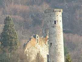
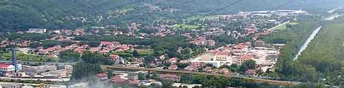
Champ-sur-Drac is a commune in the Isère department in southeastern France.
It is situated at the foot of the Alps, at the confluence of the Romanche and the Drac. Population of the whole metropolitan area at the 1999 census was 7309 inhabitants and population of the intercommunality at the 2005 census was 26,761 inhabitants.
Population
| Historical population | ||
|---|---|---|
| Year | Pop. | ±% |
| 1962 | 2,232 | — |
| 1968 | 2,316 | +3.8% |
| 1975 | 2,605 | +12.5% |
| 1982 | 3,094 | +18.8% |
| 1990 | 3,140 | +1.5% |
| 1999 | 3,262 | +3.9% |
| 2011 | 3,113 | −4.6% |
Sister city
-
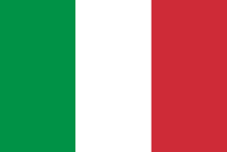 Torviscosa, Italy (since 2006).
See also
References
| Wikimedia Commons has media related to Champ-sur-Drac. |