Chamarajanagar
| Chamarajanagar ಚಾಮರಾಜನಗರ Chamarajanagara | |
|---|---|
| Town | |
|
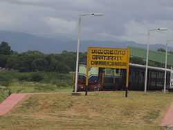
Chamarajanagar Railway Station | |
 Chamarajanagar Location in Karnataka, India | |
| Coordinates: 11°55′34″N 76°56′25″E / 11.9260°N 76.9402°ECoordinates: 11°55′34″N 76°56′25″E / 11.9260°N 76.9402°E | |
| Country |
|
| State | Karnataka |
| District | Chamarajanagara |
| Languages | |
| • Official | Kannada |
| Time zone | IST (UTC+5:30) |
| PIN | 571 313 |
| Telephone code | 08226 |
| Vehicle registration | KA-10 |
| Website | www.chamarajanagaracity.gov.in |
Chamarajanagar is a district and town in the southern end of Karnataka, a state in India. Named after Chamaraja Wodeyar IX, the king of Mysore, it is one of the less developed towns in Karnataka despite its proximity to the interstate highway linking Tamil Nadu and Kerala.
Geography
Chamarajnagar is located at 11°55′N 76°57′E / 11.92°N 76.95°E.[1] It has an average elevation of 662 metres (2171 feet).
Demographics
As of the 2008 India census,[2] Chamrajanagar had a population of 77,811. Males constituted 51% of the population and females 49%. Chamrajanagar has an average literacy rate of 60%, higher than the national average of 59.5%; with male literacy of 65% and female literacy of 54%. 12% of the population is under 6 years of age.
Transport
Railway Station
Chamarajanagar Railway Station is the 'Southern Most' rail point of Karnataka. Its station code is CMNR.
Air
The nearest regional airport is Mandakalli Airport in Mysore. The nearest international airports are in Bangalore and Coimbatore.
Nearby Tourist Attractions
- Chamarajeshwara temple
- Sri Vijaya Parsvanatha Jain Basadi
- Janana Mantapa of Sri Chamaraja Wodeyar
- B R Hills (Biligiri Rangana Betta)
- Haralukote Anjaneya & Janardhanaswamy Temple
- Bannari Amman Temple
- K.Gudi (Jungle Lodge)
- MM Hills (Male Mahadeshwara Betta)
- Bandipura (Wild life Sanctuary)
- Talkad (Pilgrimage centre)
- Kelasuru Jain temple
- Sri Adinatha Swamy Digambar Jain temple
- Somanathpur (Historical place)
- Shivanasamudra (Shivanasamudra Falls)
- Karivaradarayana Hills
- Sri Chandra Natha swamy Hill, Jain hill ( Jaingall betta)
- Chikkahole Reservoir
- Suvarnavathi Reservoir
- Sri Kshetra Kanakagiri, Jain Pilgrim Centre
- Sri Vardhamana swamy jain temple
- Himavad Gopalaswamy Betta
- Sri Hulugana Maradi Venkataramanaswamy Betta
- Sri Swarnagowri Devalaya
- Sri Kaavi Basaveswara Temple
- Sri Bolagudda Mahadeshwara Temple
- The Bhavani sagar dam
- Mayamma Temple Mukkadahalli
Notable Personalities of the District
- Yadayur Siddalingeshwara, 15-16th century, saint & philosopher
- Nijaguna Shivayogi, 16-17th century, saint, classical musician & poet
- Sanchi Honnamma, 17th century, revolutionary lady poet
- Rajkumar, prominent Kannada film actor
References
- ↑ Falling Rain Genomics, Inc - Chamarajnagar
- ↑ "Census of India 2001: Data from the 2001 Census, including cities, villages and towns (Provisional)". Census Commission of India. Archived from the original on 2004-06-16. Retrieved 2008-11-01.
External links
| Wikimedia Commons has media related to Chamarajanagar. |