Chakaria Upazila
| Chakaria চকোরিয়া | |
|---|---|
| Upazila | |
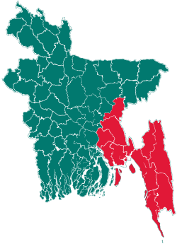
 Chakaria Location in Bangladesh | |
| Coordinates: 21°47.2′N 92°4.7′E / 21.7867°N 92.0783°ECoordinates: 21°47.2′N 92°4.7′E / 21.7867°N 92.0783°E | |
| Country |
|
| Division | Chittagong Division |
| District | Cox's Bazar District |
| Area | |
| • Total | 643.46 km2 (248.44 sq mi) |
| Population (1991) | |
| • Total | 409,346 |
| • Density | 636/km2 (1,650/sq mi) |
| Time zone | BST (UTC+6) |
| Website | bazar/Chakaria.gif Official Map of Chakaria |
Chakaria (Bengali: চকোরিয়া) is an Upazila of Cox's Bazar District in the Division of Chittagong, Bangladesh. Chakaria Upazila (cox's bazar district) with an area of 643.46 km2, is bounded by Lohagara, Banshkhali and Lama upazilas on the north, Cox's Bazar sadar, and ramu upazilas on the south, Lama and naikhongchhari upazilas on the east, maheshkhali and kutubdia upazila on the west. The upazila is surrounded by the matamuhuri, Bara Matamuhuri, Maheshkhali and Kutubdia Channel. The upazila more often fall victim to cyclone and tidal bore. The devastating cyclone and tidal bore of 29 April 1991 caused serious damage to the upazila with a death toll of 16705 persons.
Geography
Chakoria is located at 21°47′10″N 92°04′40″E / 21.7861°N 92.0778°E . It has 63671 units of house hold and total area 643.46 km². Once there was a mangrove forest named Chakaria Sunderban here. But now it is no more.
Demographics
According to the 1991 Bangladesh census, Chakaria had a population of 409, 346. Males constituted 51.87% of the population, and females 48.13%. The population aged 18 or over was 176, 608. Chakaria had an average literacy rate of 23.4% (7+ years), against the national average of 32.4%.[1]
Chakaria Town
Chakaria Town consists of 9 wards and 22 mahallas with an area of 2.95 km2. It has a population of 50716; male 52.64%, female 47.36%. Literacy rate among town people is 34.5%. It has three dakbungalows.
Administration
Chakaria thana was constituted in 1793 and was turned into an upazila in 1983. It consists of 17 union parishads, one municipality, 64 mouzas and 340 villages.
Union Parishads
- Badarkhali Union Parishad
- Barawtali Union Parishad
- Bheola Manik Char Union Parishad
- Bomobilchari Union Parishad
- Chiringa Union Parishad
- Dulhazara Union Parishad
- Purba Barabheola Union Parishad
- Fasiakhali Union Parishad
- Harbang Union Parishad
- Kakara Union Parishad
- Kaiarbil Union Parishad
- Khutakhali Union Parishad
- Lakhyarchar Union Parishad
- Saharbil Union Parishad
- Paschim Bara Bheola Union Parishad
- Demushia Union Parishad
- Konakhali Union Parishad
- Surajpur-Manikpur Union Parishad
Archaeological Heritage
Tomb of Shah Umar, Sat-gumbad Masjid of Fazl Quke at Manikpur (1873), Hasher Dighi, Bir Kamla Dighi.
Historical Events
During the war of liberation in 1971, the Pak army killed 13 villagers by gunshot and burnt more than one hundred houses and shops in different places of the upazila.
Marks of War of Liberation
Shaheed Abdul Hamid memorial monument.
Population
409346; male 51.48%, female 48.52%; Muslim 93.4%, Hindu 5.4%, Buddhist 1.02%, Christian 0.18%. Ethnic nationals: Magh, Marma, Moorang and Chakma.
Religious Institutions
Mosque 400, temple 99, church 3, pagoda 16, mazar 6.
Literacy and Educational Institutions
Average literacy 23.15%; male 29.2%, female 17.1%. Educational institutions: college 5, government high school 2, non-government high school 37, madrasa 26, government primary school 104, non-government primary school 77.
Old Institutions
Fasiakhali Government Primary School (1917) Manikpur Burmese Government Primary School (1828), Harbang Burmese Government Primary School, Harbang Government Primary School (1884), Pekua Government Primary School (1918), Chakaria Government High School (1919), Sahrbil Anwarul Ulum Senior Madrasa (1918).
Newspapers and Periodicals
Weekly Chakori, fortnightly Mehdi.
Cultural Organizations Club
52, literary organisation 3, women's organisation 22, theatre party 2, playground 50.
Main occupations
Agriculture 29.55%, fishing 2.03%, forestry 1.56%, agricultural labourer 24.5%, non-agricultural labourer 6.74%, commerce 14.02%, service 4.96%, transport 1.98%, others 14.66%.
Main Exports
Shrimp, salt, tobacco, ground nut, mustard seed, flour, water melon, timber.
See also
References
- ↑ "Population Census Wing, BBS.". Archived from the original on 2005-03-27. Retrieved November 10, 2006.
| |||||||||||||||||||||||||||||||||||||||||||||||||||||