Ch'illiwa
| Ch'illiwa | |
|---|---|
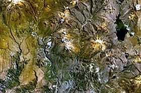 The lake Wilaquta (on the right) and Ch'illiwa southwest of it as seen from above (NASA Landsat7 image) | |
| Elevation | 4,800 m (15,700 ft)[1] |
| Location | |
 Ch'illiwa Peru | |
| Location | Peru, Tacna Region, Tarata Province |
| Range | Andes |
| Coordinates | 17°13′33″S 70°04′35″W / 17.22583°S 70.07639°WCoordinates: 17°13′33″S 70°04′35″W / 17.22583°S 70.07639°W |
Ch'illiwa (Aymara for a species of grass[2] (Festuca dolichophylla), hispanicized spelling Chillihua) is a mountain in the Andes of southern Peru, about 4,800 metres (15,748 ft) high. It is located in the Tacna Region, Tarata Province, Susapaya District. Ch'illiwa lies southwest of the lakes Wilaquta and Ñiq'i Quta ("mud lake").[1]
References
- ↑ 1.0 1.1 escale.minedu.gob.pe - UGEL map of the Tarata Province (Tacna Region)
- ↑ Radio San Gabriel, "Instituto Radiofonico de Promoción Aymara" (IRPA) 1993, Republicado por Instituto de las Lenguas y Literaturas Andinas-Amazónicas (ILLLA-A) 2011, Transcripción del Vocabulario de la Lengua Aymara, P. Ludovico Bertonio 1612 (Spanish-Aymara-Aymara-Spanish dictionary)