Chöpfenberg
| Chöpfenberg | |
|---|---|
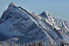 View from the west side | |
| Elevation | 1,896 m (6,220 ft) |
| Prominence | 465 m (1,526 ft)[1] |
| Location | |
 Chöpfenberg Location in Switzerland | |
| Location | Schwyz/Glarus, Switzerland |
| Range | Swiss Prealps |
| Coordinates | 47°7′7″N 8°58′7″E / 47.11861°N 8.96861°ECoordinates: 47°7′7″N 8°58′7″E / 47.11861°N 8.96861°E |
The Chöpfenberg (1,896 m) is a mountain of the Swiss Prealps, located on the border between the Swiss cantons of Schwyz and Glarus. It lies on the range north of the Mutteristock, between the valleys of the Wägitalersee and the Linth.