Château-Rouge
| Château-Rouge | ||
|---|---|---|
 | ||
| ||
 Château-Rouge | ||
|
Location within Lorraine region  Château-Rouge | ||
| Coordinates: 49°16′51″N 6°35′52″E / 49.2808°N 6.5978°ECoordinates: 49°16′51″N 6°35′52″E / 49.2808°N 6.5978°E | ||
| Country | France | |
| Region | Lorraine | |
| Department | Moselle | |
| Arrondissement | Boulay-Moselle | |
| Canton | Bouzonville | |
| Intercommunality | Communauté de communes de la Houve | |
| Government | ||
| • Mayor (2008–2014) | René Bernard | |
| Area1 | 4.32 km2 (1.67 sq mi) | |
| Population (1999)2 | 179 | |
| • Density | 41/km2 (110/sq mi) | |
| INSEE/Postal code | 57131 / 57320 | |
| Elevation |
249–348 m (817–1,142 ft) (avg. 300 m or 980 ft) | |
|
1 French Land Register data, which excludes lakes, ponds, glaciers > 1 km² (0.386 sq mi or 247 acres) and river estuaries. 2 Population without double counting: residents of multiple communes (e.g., students and military personnel) only counted once. | ||

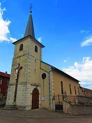
Château-Rouge (Lorraine Franconian: Roudendroff) is a commune in the Moselle department in Lorraine in north-eastern France.
Previous names: Château Rouge ou Rothdorf (1793), Rothdorff (1794-1795), Châteaurouge (1801).