Central Square Historic District (Stoneham, Massachusetts)
|
Central Square Historic District | |
 | |
 | |
| Location | Roughly bounded by Main, Central, Church, Winter and Common Sts., Stoneham, Massachusetts |
|---|---|
| Coordinates | 42°28′15″N 71°5′57″W / 42.47083°N 71.09917°WCoordinates: 42°28′15″N 71°5′57″W / 42.47083°N 71.09917°W |
| Architect | Tidd,William; Brown,Charles |
| Architectural style | Mid 19th Century Revival, Classical Revival, Late Victorian |
| Governing body | U.S. POSTAL SERVICE |
| MPS | Stoneham MRA |
| NRHP Reference # |
89002277 [1] |
| Added to NRHP | January 17, 1990 |
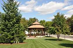
The Central Square Historic District is a historic district roughly bounded by Main, Central, Church, Winter and Common Streets in Stoneham, Massachusetts.
The district was added to the National Register of Historic Places in 1990.[1] It includes several properties that are separately listed on the National Register, including the Dow Block, which dominates Central Square,[2] and the Amasa Farrier House.
See also
- National Register of Historic Places listings in Stoneham, Massachusetts
- National Register of Historic Places listings in Middlesex County, Massachusetts
References
- ↑ 1.0 1.1 "National Register Information System". National Register of Historic Places. National Park Service. 2008-04-15.
- ↑ "NRHP nomination for Dow Block". Commonwealth of Massachusetts. Retrieved 2014-01-24.
| |||||||||||||||||||||||||||||||||||||||||||||||||||||||
