Central Sava Valley
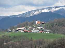
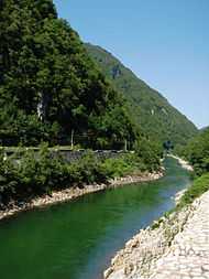
The Central Sava Valley (Slovene: Zasavje) is a region along the Sava in central Slovenia. The region consists of five municipalities: Zagorje ob Savi, Trbovlje, Hrastnik, Litija, and Šmartno pri Litiji. Several coal mines operated in the Central Sava Valley, although all except Rudnik Trbovlje-Hrastnik are now defunct. It is surrounded by the Sava Hills, with Kum (1,220 metres or 4,000 feet) on the right side of the Sava and Black Peak (1,204 metres or 3,950 feet) on Mount Čemšenik at the left side of the Sava, as its highest peaks.
History
The Slovene term Zasavje for this area[Note 1] is a recent coinage[2][3] that did not come into general use until the 1920s, with the western part of the region being part of Carniola (Slovene: Kranjska) and its eastern part (Trbovlje and Hrastnik) belonging to Styria (Slovene: Štajerska). Due to its coalmining tradition, it was one of the first regions in today's Slovenia to be industrialized in the 19th century. Construction of the Austrian Southern Railway, which led from Vienna to Trieste through Slovenia and the Central Sava Valley in 1849, was a major milestone.
Tourism
Major attractions include Vače with finds from the Early Iron Age (among them the Vače situla) and the Geometric Centre of Slovenia (GEOSS), Bogenšperk Castle near Šmartno pri Litiji, and Izlake with the Medijske Toplice thermal baths.
Notes
- ↑ There is also a low-lying agricultural area known as Zasavje (literally, 'behind the Sava River') in the Lower Sava Valley between Krška Vas and the Sava River.[1]
References
- ↑ Zasavje (fields in the Lower Sava Valley) at Geopedia
- ↑ Melik, Anton (ed.). 1959. Posavska Slovenija, Slovenija. Geografski opis II. Opis slovenskih pokrajin vol. 3. Ljubljana: Slovenska matica, p. 261.
- ↑ Vrišer, Igor. 1963. Rudarska mesta Zagorje, Trbovlje, Hrastnik. Ljubljana: Slovenska Matica, p. 13
Coordinates: 46°4′47.64″N 15°0′26.37″E / 46.0799000°N 15.0073250°E