Central Falls Mill Historic District
|
Central Falls Mill Historic District | |
 | |
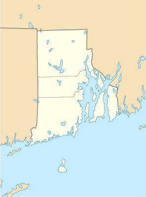 | |
| Location | Central Falls, Rhode Island |
|---|---|
| Coordinates | 41°53′11″N 71°22′55″W / 41.88639°N 71.38194°WCoordinates: 41°53′11″N 71°22′55″W / 41.88639°N 71.38194°W |
| Built | 1825 |
| Architect | Walker,William R. |
| Architectural style | No Style Listed |
| Governing body | Private |
| MPS | Central Falls MRA |
| NRHP Reference # | 76000007[1] |
| Added to NRHP | July 2, 1976 |
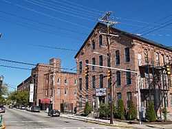
The Central Falls Mill Historic District is located between Roosevelt Avenue and the Blackstone River in Central Falls, Rhode Island. It encopasses a collection of six mill buildings, as well as a stone dam which impounds the river, representing the finest mill constructions in the city during the 19th century. The layout of the buildings, whose short ends face the river and Roosevelt Avenue, was defined by a series of trenches (now filled in) which channeled water from the river to power the machinery of the mills. The oldest building dates to 1825, and the most recent to c. 1910; all have been modified to some extent by later industrial tenants.[2]
The historic district was listed on the National Register of Historic Places on July 2, 1976.[1]
See also
References
- ↑ 1.0 1.1 "National Register Information System". National Register of Historic Places. National Park Service. 2008-04-15.
- ↑ "Historical Resources of Central Falls (PDF page 12)". Rhode Island Preservation. Retrieved 2014-07-15.
| ||||||||||||||||||||||||||