Cathedral Gardens

Cathedral Gardens is an open space in Manchester city centre, in North West England. It is bounded by Victoria railway station to the north, Chetham's School of Music to the west, the perimeter of Manchester Cathedral and The Triangle on Fennel Street to the south and Urbis to the east.
Earliest history


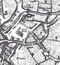
Until the Industrial Revolution, Manchester was little more than a small market town, and the town was centred on the cathedral. The area where Cathedral Gardens now stands was enclosed by small cottages. During the Industrial Revolution Manchester expanded rapidly, and its centre shifted further south. Cathedral Gardens is overlooked by Chetham's Library, part of the Chetham's School of Music, where Karl Marx and Friedrich Engels wrote.
After Victoria station was built in the 1860s, the site housed travellers, hotels and shops until urban planning in the 1980s, demolished the hotel which faced south on Fennel Street and the Corn Exchange. The site was used as a car park until the regeneration of Manchester city centre.
Manchester IRA bombing
The Provisional IRA planted bombs on mainland British cities for thirty years. Manchester was targeted in the 1990s, which culminated in the Manchester IRA bombing on 15 June 1996.
The bomb exploded on a Saturday morning while Manchester was hosting the 1996 UEFA European Football Championship and was the largest bombing on British soil. It created devastation for half a mile around the explosion site. The Marks and Spencer store was damaged beyond repair but nobody was killed.
Regeneration
After the bombing, the government, granted Manchester City Council several million pounds to redevelop the most damaged sites in the city. After an International competition, several architects were charged with creating an accessible open space linking St Anne’s Square to the Cathedral. After the completion of the new Marks and Spencer flagship store (then the largest in the world) and the Urbis gallery, Cathedral Gardens was opened to the public.
Layout
Cathedral Gardens comprises wide areas of grassy plots, surrounded by paved walking areas and stylised concrete sitting areas. On the west side, is a short water feature.[1][2]
References
- ↑ Cathedral Gardens, Commission for Architecture and the Built Environment, retrieved 6 June 2012
- ↑ Cathedral Gardens, Manchester, BDP, retrieved 6 June 2012
Coordinates: 53°29′08″N 2°14′34″W / 53.48556°N 2.24278°W
| ||||||||||