Castlereagh Street
| Castlereagh Street New South Wales | |
|---|---|
 North end South end | |
| Coordinates | 33°52′49.4″S 151°12′30.0″E / 33.880389°S 151.208333°E |
| General information | |
| Type | Street |
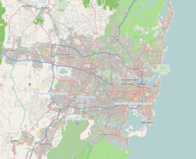
| Location | Sydney |
| Length | 1.6 km (1 mi)[1] |
| Major junctions | |
| North end | Hunter Street |
| South end | Hay Street |
| Location(s) | |
| LGA(s) | Sydney |
| Major suburbs | Sydney CBD |


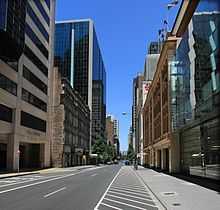
Castlereagh Street is a major north-south street in the centre of Sydney's central business district.
Description
Castlereagh Street runs from Hunter Street in the north to Hay Street, near Belmore Park, in the south.[2] The street is one-way southbound to traffic. It is lined by many of Sydney's most expensive boutiques and jewellery stores,[3] and contained the Australia Hotel, whose foundation stone was laid by Sir Henry Parkes, and the Theatre Royal both now demolished, victims of Sydney's modernist make-over of the 1970s.
A single-line electric tramway formerly ran northbound up Castlereagh Street (in a loop paired with Pitt Street), between Central Station and Circular Quay. It was closed in the late 1950s when trams were eliminated as a form of transport in Sydney. The street is now used by buses as well as general traffic.
A significant heritage building is the fire station at 211–217 Castlereagh Street. This building dates back to the 1880s and was designed in the Victorian Free Classical style. Its four storeys are made of tuckpointed brick and stucco. It has a state heritage listing.[4]
See also
Australian Roads portal
References
Route map: Bing
- ↑ Google (February 3, 2015). "Route north to south" (Map). Google Maps. Google. Retrieved February 3, 2015.
- ↑ Gregory's 2002 Street Directory, 66th Edition
- ↑ Where Magazine Sydney February 2011 Pg48
- ↑ State Heritage Site