Castleknock (barony)
The barony of Castleknock (Irish: Caisleán Cnucha) meaning "Cnucha's Castle")[1][l 1] is a feudal title of nobility and one of the baronies of Ireland. Originally part of the Lordship of Meath, it was then constituted as part of the old county of Dublin. Today, it lies in the modern county of Fingal. The barony was created by Hugh de Lacy, Lord of Meath as his own feudal barony, held directly from himself in capite. His vassals were commonly called "De Lacy's Barons".[2] The first vassal was Hugh Tyrrel. At the heart of the barony is the civil parish of the same name - Castleknock - which is one of eight civil parishes in the barony. In the townland of Castleknock itself is the location of the eponymous "Cnucha's Castle" - Castleknock Castle. The town with the biggest population in the barony is Blanchardstown.
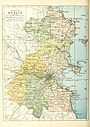
Location
It is one of seven and a half baronies that used to comprise the old county of Dublin.[3] It stretches from Cabra to Blanchardstown (from east to west) and from Finglas to Chapelizod (from north to south). It is located between the baronies of Coolock to the east, Nethercross to the north and Dublin to the southwest. The River Liffey separates it from the remaining baronies. The whole of the barony is contained within the modern county of Fingal and it is subject to Fingal County Council.
Legal context
Baronies were created after the Norman invasion of Ireland as subdivisions of counties and were used for administration. At the time of its creation, Castleknock was part of the Lordship of Meath. While baronies continue to be officially defined units, they are no longer used for many administrative purposes. While they have been administratively obsolete since 1898, they continue to be used in land registration, and specification such as in planning permissions. In many cases, a barony corresponds to an earlier Gaelic túath which had submitted to the Crown. This is probably true in the case of Castleknock.
Civil parishes
Civil parish of Castleknock
Townlands in the civil parish of Castleknock:[l 1]
| Gaelic | English |
|---|---|
| Baile an Aba | Abbotstown |
| Baile an Ásaigh | Ashtown |
| Baile an Chairpintéaraigh | Carpenterstown |
| Baile an Déanaigh | Deanestown |
| Baile an Diosualaigh | Diswellstown |
| Baile an Huntaigh | Huntstown * |
| Baile an Phóirtéaraigh | Porterstown |
| Baile Bhlainséir | Blanchardstown |
| Baile Mhistéil | Mitchelstown |
| Baile Pheiléid | Pelletstown |
| Baile Scriobail | Scribblestown |
| Baile Sheáin | Johnstown |
| An Chabrach | Cabra |
| Caisleán Cnucha | Castleknock (incl. part of Phoenix Park) |
| Ceapach | Cappoge or Cappagh |
| Cnoc na gCaorach | Sheephill |
| An Chorr Dhubh | Corduff |
| Dún Sinche | Dunsink |
| Páirc Anna | Annfield |
| Snugborough | Snugborough |
| Steach Gob | Astagob |
- Not to be confused with Huntstown in Mulhuddart.
Civil parish of Chapelizod
Chapelizod contains a single townland of the same name.[l 1] However, 465 acres are within the walls of the Phoenix Park while the village proper, outside the walls, contains only 67 acres.
Civil parish of Cloghran
Cloghran consists of three townlands: Ballycoolen, Cloghran and Grange.[l 1] Most of the land in the parish is taken up with the "Ballycoolen Industrial Estate".
Civil parish of Clonsilla
Townlands in the civil parish of Clonsilla:[l 1]
| Gaelic | English |
|---|---|
| Baile an Bhearbóraigh | Barberstown |
| Baile an Bhlácaigh | Blakestown |
| Baile an Hartaigh | Hartstown |
| Baile Fiobail nó Páirc Hans | Phibblestown or Hansfield |
| Baile Lotrail | Luttrellstown or Woodlands |
| Baile Uí Cheallaigh | Kellystown |
| Cluain Saileach | Clonsilla |
| Cnoc an Sciobóil | Barnhill |
| Cúil Mhín | Coolmine |
| Gort na Giolcaí | Broomfield |
| Móinteán na gCaorach | Sheepmoor |
| Steach Gob | Astagob |
| Teach Chainnigh | Castaheany Note 1 |
- Note 1 The largest population centre in Castaheany / Hansfield is Ongar.
Civil parish of Finglas
Townlands of the parish of Finglas are split among three baronies.[l 1] There are also three parcels of the parish within Castleknock itself:
- The northern parcel, wedged between Ward and St Margarets, has Shallon, Bishopswood, Broghan and Kilshane.
- The central parcel, wedged between Tyrrelstown and Goddamendy, contains the single townland of Cruiserath
- The southern parcel contains the village proper.
Civil parish of Mulhuddart
Mulhuddart has 22 townlands:[l 1]
- Huntstown
- Littlepace
- Tyrrelstown
Civil parish of St James'
The bulk of St. James' parish lies south of the River Liffey. Two townlands, which are situated north of the river, are part of the barony of Castleknock.[l 1] They are:
- Phoenix Park; the eastern part containing the Magazine fort, the Zoological Gardens, the Wellington Monument and the Criminal Courts of Justice.
- Longmeadows which is the strip of land between the Park walls and the river from its narrowest pinch point to Islandbridge on the South Circular Road.
Civil parish of Ward
Townlands in the parish of Ward: Cherryhound, Irishtown, Killamonan, Newpark, Spricklestown, Ward Lower and Ward Upper.[l 1]
History
The feudal barony was created out of the Lordship of Meath by Hugh de Lacy, Lord of Meath and granted in 1177 to Hugh Tyrrel. It was held for three and a half knight's fees, owed to the superior Lord of Fingal. The title and lands of Castleknock were held by the Tyrell family until 1370 when Hugh Tyrell and his wife died of the Plague. It later passed to the Viscount Gormanston.
See also
List of subdivisions of County Dublin
References
From "Irish placenames database". logainm.ie (in English and Irish). Department of Community, Rural and Gaeltacht Affairs. Retrieved 25 April 2014. :
From other sources:
- ↑ History of the name of Castleknock.
- ↑ Vicissitudes of Families by Sir Bernard Burke, Ulster King of Arms, Longman Green Longman and Roberts, Paternoster Row, London, 1861 (pages 363-364)
- ↑ According to the "Local Government Act, 2001", section 10(2): "The State continues to stand divided into local government areas to be known as counties and cities which are the areas set out in Parts 1 and 2, respectively, of Schedule 5." It is clear from SCHEDULE 5, Local Government Areas (Counties and Cities, PART 1, that "Dublin" is defined only as a city (as distinct from a county).
External links
- Local Government Act, 2001
- Walsh, Dennis (2003). "Barony Map of Ireland". Archived from the original on 15 January 2007. Retrieved 2007-02-13. Source given is "Ordnance survey".
| |||||||||||||