Castle, Bedford
| Castle | |
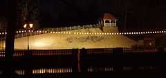
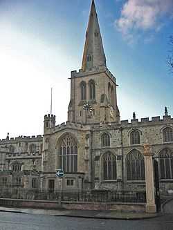
 Bedford town centre, in the Castle area |
|
 Castle |
|
| Population | 8,259 [1] |
|---|---|
| OS grid reference | TL052498 |
| Unitary authority | Bedford |
| Ceremonial county | Bedfordshire |
| Region | East |
| Country | England |
| Sovereign state | United Kingdom |
| Post town | BEDFORD |
| Postcode district | MK40, MK42 |
| Dialling code | 01234 |
| Police | Bedfordshire |
| Fire | Bedfordshire and Luton |
| Ambulance | East of England |
| EU Parliament | East of England |
| UK Parliament | Bedford |
|
|
Coordinates: 52°08′13″N 0°27′46″W / 52.13691°N 0.46287°W
Castle is an electoral ward and area of Bedford, Bedfordshire, England.
The boundaries of Castle are approximately Bromham Road and Goldington Road to the north, Denmark Street and George Street to the east, Rope Walk to the south, with the Midland Main Line railway line and Ashburnam Road to the west.
The Castle area includes almost all of Bedford town centre, as well as the eastern section of the Castle Road neighbourhood. Castle is the only area and ward in the town of Bedford to be located on both sides of the River Great Ouse.
History
The name 'Castle' comes from Bedford Castle which is located in the area. William II granted the Barony of Bedford to Paine de Beauchamp who built the castle. The Castle was destroyed in 1224 by Henry III. In 1166 The town of Bedford was given a Charter. This was when Bedford Market was founded in the Castle area.
To the south of the river, Cauldwell Priory was built in the area by Franciscan Friars in 1238.[2] The priory included a leper colony dedicated to St Leonard. The priory was dissolved by King Henry VIII in 1541, and around this time a new bridge was built over the River Great Ouse, and the town of Bedford began to expand to the south of the river. The river became navigable as far as Bedford by 1689.[3] Up until this time, Bedford was a small agricultural town, with wool being an important industry in the area for much of the Middle Ages. However, with the opening up of the River Great Ouse, wool declined in importance and brewing became a major industry in the town.[4]
In 1660 John Bunyan was imprisoned for 12 years in Bedford Gaol, which was located in the Castle area. It was here that he wrote The Pilgrim's Progress.
The 19th Century saw Bedford transform into an important engineering hub. In 1832 Gas lighting was introduced into the Castle area, and the railway reached Bedford in 1846. Bedford's Corn Exchange was built in the area in 1849, and the first drains and sewers were dug in 1864. Bedford's growth in the 19th century saw the Castle area expand along the river to the east.[4]
After the Second World War, the Cauldwell Street neighbourhood of terraced houses was demolished, making way for new offices and public buildings, including headquarters for Bedford College and Bedfordshire County Council.
Governance
Castle is an unparished area, with all community services under the direct control of Bedford Borough Council. Castle elects two councillors to Bedford Borough Council, one of which is currently from the Conservative Party and the other is currently an independent.
Economy
Virtually all of the Bedford's central business district is located in Castle ward, with many major High Street shops being located here. The main shopping areas of note are the High Street which includes a Debenhams Department Store, a Wilkinson store, banks, many pubs, nightclubs and restaurants. The Harpur Centre is Bedford's main shopping centre. Branches of Boots, TK Maxx, Primark, Argos and various other stores are located here. Located in the eastern section of the Castle Road neighbourhood there are a host of smaller independent shops and community stores.[5]
Many of Bedford's central amenities are located in the Castle area, including Bedford's main post office, town hall, market, magistrates court, police station, Bedford bus station and Bedford railway station. Two of Bedford's largest hotels are located in the area - The Swan Hotel on the High Street,[6] and the Bedford Park Inn situated across the river on St Mary's Street.[7]
Also south of the river, there are a few more shops located around the St Mary's Street/St John's Street/Cauldwell Street area. It is here that Bedford College is located, as well as a Farmfoods store. Bedford Borough Hall, the administrative headquarters of Bedford Borough Council is also located here.[8]
Education
There are two lower schools in Castle - Priory Lower School located on Greyfriars,[9] and Castle Lower School situated on Goldington Road. There are no middle schools in the area, and most Castle students attend Newnham Middle School or Goldington Academy in nearby areas. For upper school education, most Castle students attend Biddenham Upper School.[10] However, Bedford Free School is a secondary school which opened in the area in September 2012, and enrols students aged 11+. Bedford Free School accepts students from all over Bedford Borough, and was the first free school to be established in the borough.
Bedford Girls' School is an independent school for girls aged 7–18, located on Cardington Road in the Castle area. The school is part of the Harpur Trust.[11]
Bedford College (situated in Castle) offers a range of further education courses including GCSEs, A Levels, Apprenticeships and Access courses.[12]
Religious sites
There are many places of worship in Castle, some of which serve the entire Bedford area -
- St Paul's Church, Bedford (Church of England), located on St Paul's Square[13]
- Bedford Spiritualist Church, located on Ashburnam Road[14]
- Italian Pentecostal Church, also on Ashburnam Road
- Mount Zion Church, located on Midland Road[15]
- St Joseph & The Holy Child Roman Catholic Church, also on Midland Road
- St Frances Cabrini Italian Church, located on Woburn Road
- Rutland Road Church, located on Rutland Road[16]
- The Miracle of God in Christ Church, located on Alexandra Road[17]
- The Bedford Jamee Masjid & Islamic Cultural Centre, located on Brereton Road[18]
- Bedford Pentecostal Church, located on Roise Street[19]
- The Salvation Army run the Bedford Congress Hall, located on Commercial Road[20]
- The Bedford Bangladeshi Mosque & Islamic Mission, also on Commercial Road[18]
- The Bunyan Meeting Free Church & John Bunyan Museum, located on Mill Street[21]
- Polish Church of Sacred Heart of Jesus & St Cuthbert, also on Mill Street[22]
- The Panacea Society has its international headquarters on Albany Road[23]
- The Providence Baptist Chapel, located on Rothsay Road
- The St Josaphat Ukrainian Church (Byzantine Rite), located on York Street
- St John's and St Leonard's Church (Church of England), located on St Johns Street and Victoria Road[24]
- Southside Family Church (Newfrontiers), also on St Johns Street[25]
- The Kings Arms Church (Newfrontiers) meets at Bedford Girls' School on Cardington Road[26]
Community facilities
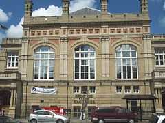
The main open space in the Castle area is Russell Park and the Embankment of the River Great Ouse. The Bedford Corn Exchange, The Higgins Art Gallery & Museum and Esquires (a live music venue) are also located in the area.
References
- ↑ Neighbourhood Statistics. "Neighbourhood Statistics". Neighbourhood Statistics. Retrieved 2012-08-06.
- ↑ "Bedford - Victorian Super Sleuth Quiz 1 Extra - Bedfordshire's Virtual Library". Galaxy.bedfordshire.gov.uk. 2008-02-15. Retrieved 2012-08-06.
- ↑ "'History of Bedford'". Bedford.gov.uk. Retrieved 2012-08-06.
- ↑ 4.0 4.1 http://www.localhistories.org/bedford.html 'A brief history of Bedford' by Tim Lambert
- ↑ http://comearoundtobedford.moonfruit.com/ 'Featured Business'
- ↑ "'Town Centre Guide'".
- ↑ "Park Inn, Bedford". Comearoundtobedford.moonfruit.com. Retrieved 2012-08-06.
- ↑ http://www.bedford.gov.uk/ Bedford Borough Council
- ↑ Priory Lower School
- ↑ "'Bedfordshire School Catchment Areas'". Bedford.gov.uk. 2011-09-01. Retrieved 2012-08-06.
- ↑ "Welcome to Bedford Girls' School | Welcome to Bedford Girls' School |". Bedfordgirlsschool.co.uk. Retrieved 2012-08-06.
- ↑ http://www.bedford.ac.uk/ Bedford College
- ↑ http://www.stpaulschurchbedford.org.uk/ St Paul's Church
- ↑ http://www.bedfordspiritualistchurch.org/ Bedford Spiritualist Church
- ↑ "Mount Zion Church". Cambonli01.uuhost.uk.uu.net. Retrieved 2012-08-06.
- ↑ http://www.rutlandroadchurch.org/ Rutland Road Church
- ↑ http://www.miraclecogic.org/ The Miracle of God in Christ Church
- ↑ 18.0 18.1 http://bedfordmuslims.co.uk/ Bedford & Castle Mosques
- ↑ http://www.bedfordpentecostal.org/ Bedford Pentecostal Church
- ↑ http://www.bedfordcongresshall.co.uk/ Bedford Salvation Army Congress Hall
- ↑ Bunyan Meeting Free Church & Museum
- ↑ "Polish Church of Sacred Heart of Jesus & St Cuthbert". Ppb.org.uk. Retrieved 2012-08-06.
- ↑ http://www.panacea-society.org/ The Panacea Society
- ↑ http://www.acts-online.com/ St John's & St Leonard's Church
- ↑ "Southside Church". Southside Church. Retrieved 2012-08-06.
- ↑ http://www.kingsarms.org/ The Kings Arms Church
External links
| ||||||