Carter Dome
| Carter Dome | |
|---|---|
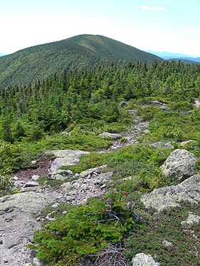 Carter Dome seen from Mt. Hight | |
| Elevation | 4,832 ft (1,473 m)[1] |
| Prominence | 2,821 ft (860 m)[1] |
| Listing |
White Mountain 4000-Footers #12 New England 50 Finest |
| Location | |
| Location | Coös County, New Hampshire, U.S. |
| Range | Carter-Moriah Range |
| Coordinates | 44°16′02″N 71°10′44″W / 44.2672877°N 71.1789625°WCoordinates: 44°16′02″N 71°10′44″W / 44.2672877°N 71.1789625°W[2] |
| Topo map | USGS Carter Dome |
Carter Dome is a mountain located in Coos County, New Hampshire. The mountain is part of the Carter-Moriah Range of the White Mountains, which runs along the northern east side of Pinkham Notch. Carter Dome is flanked to the northeast by Mount Hight and to the southwest by Wildcat Mountain (across Carter Notch).
The origins of Carter Dome's name is unknown. Local folklore suggests that it was named after a hunter named Carter, while a neighboring peak is named after his hunting partner, Hight.[3]
The mountain is ascended from the west by the Carter Dome Trail and Nineteen Mile Brook Trail, and from the east by the Black Angel Trail.[4]
See also
- Four-thousand footers
- List of mountains in New Hampshire
- White Mountain National Forest
References
- ↑ 1.0 1.1 "Carter Dome, New Hampshire". Peakbagger.com. Retrieved 2013-02-01.
- ↑ "Carter Dome". Geographic Names Information System. United States Geological Survey. Retrieved 2013-02-01.
- ↑ Lillard, David. E. Appalachian Trail Names. Stackpole Books. Retrieved 2008-06-16.
- ↑ "Carter Dome". Hikethewhites.com. Retrieved 2011-10-31.
External links
- "Hiking Carter Dome". Appalachian Mountain Club.
- "Carter Dome". SummitPost.org.
| ||||||||||||||||||||||||||||||||||||||||||||||||||||||||||||||||||||||