Carnic Alps
| Carnic Alps | |
|---|---|
| Friulian: Alps Cjargnelis | |
|
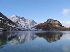
Volaia Lake in the Carnic Alps | |
| Highest point | |
| Peak | Coglians |
| Elevation | 2,782 m (9,127 ft) |
| Coordinates | 46°36′N 12°53′E / 46.600°N 12.883°E |
| Geography | |
| Countries | Austria and Italy |
| Lander, Regioni | Tyrol, Carinthia, Friuli-Venezia Giulia and Veneto |
| Range coordinates | 46°30′N 13°00′E / 46.5°N 13°ECoordinates: 46°30′N 13°00′E / 46.5°N 13°E |
| Parent range | Southern Limestone Alps |
| Geology | |
| Orogeny | Alpine orogeny |
The Carnic Alps are a range of the Southern Limestone Alps in East Tyrol, Carinthia, Friuli (Province of Udine) and, marginally, in Veneto.
Etymology
They are named after the Roman province of Carnia, which probably has a Celtic origin.
The mountains gave their name to the stage on the geologic time scale known as Carnian.
Geography
They extend from east to west for about 100 km (62 mi) between the Gail River, a tributary of the Drava and the Tagliamento, forming the border between Austria and Italy.
Alpine Club classification
The Carnic Alps are divided into two distinct areas:
|
Notable peaks
Among the most important mountains of the range are:
- Coglians / Hohe Warte (2,782 m)
- Kellerwand (2,775 m)
- Monte Peralba / Hochweißstein (2,694 m)
- Monte Cavallino / Große Kinigat (2,689 m)
- Rosskopf (2,603 m)
- Monte Terza Grande (2,586 m)
- Monte Bìvera (2,474 m)
- Creta Forata (2,462 m)
- Helm (2,434 m)
- Gailtaler Polinik (2,332 m)
- Trogkofel (2,280 m)
- Monte Sernio (2,187 m)
Mountain passes
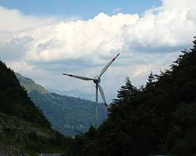
Wind turbine on the Austrian side of the Plöcken Pass
The chief passes of the Carnic Alps are:
- Plöcken Pass (Tolmezzo to Kötschach-Mauthen), road (1,360 m)
- Naßfeld Pass (Pontebba to Hermagor-Pressegger See), road (1,552 m)
- Oefnerjoch (Forni Avoltri to Sankt Lorenzen im Lesachtal), foot path (2,301 m)
- Wolayer Pass (same to Kötschach-Mauthen), foot path (1,922 m)
See also
References
| Wikimedia Commons has media related to Carnic Alps. |
External links
| ||||||||