Caracaraí
| Caracaraí | |||
|---|---|---|---|
| Municipality | |||
| The Municipality of Caracaraí | |||
|
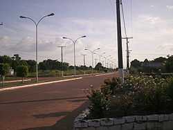
An avenue in Caracaraí | |||
| |||
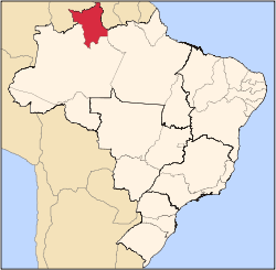
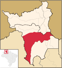 Location of Caracaraí in the State of Roraima | |||
| Coordinates: 01°48′57″S 61°07′40″W / 1.81583°S 61.12778°WCoordinates: 01°48′57″S 61°07′40″W / 1.81583°S 61.12778°W | |||
| Country |
| ||
| Region | North | ||
| State |
| ||
| Founded | 1955 | ||
| Government | |||
| • Mayor | Antonio Eduardo Filho (PR) | ||
| Area | |||
| • Total | 47,410.891 km2 (18,305.447 sq mi) | ||
| Elevation | 52 m (171 ft) | ||
| Population (2012) | |||
| • Total | 19,019 | ||
| • Density | 0.40/km2 (1.0/sq mi) | ||
| [1] | |||
| Time zone | UTC-4 (UTC-4) | ||
| HDI (2000) | 0.702 – medium[2] | ||
| Website | www.caracarai.rr.gov.br | ||

Caracaraí is a municipality located in the state of Roraima in Brazil. Its population is 17,746 and its area is 47,411 km², making it the largest municipality in Roraima state. Its territory cuts Roraima's in two and keeps boundaries with both the Brazilian state of Amazonas and Venezuela (though it is not the only municipality in the state to do so; Caroebe also borders both the state and the country, and has boundaries with Pará too.
References
- ↑ "2012 Populational Estimate". Censo Populacional 2012. Instituto Brasileiro de Geografia e Estatística (IBGE). July 2012. Retrieved September 8, 2012.
- ↑ - UNDP
| |||||||||||||||||||||||||