Cape Lopez
Map of Gabon
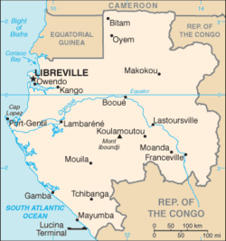
Cape Lopez (French: Cap Lopez) is a 55 km-long peninsula on the coast of west central Africa, in the country of Gabon. It separates the Gulf of Guinea from the South Atlantic Ocean, and is located at latitude -0.63° (0° 38' S) and longitude 8.7° (8° 42' E). Lying in the delta of the Ogooué River, it shelters the seaport of Port-Gentil. A lighthouse has existed on the Cape since 1897; the current tower was built in 1911, but has been inactive for many years and is in danger of collapsing from erosion.[1]
It is named after the Portuguese explorer Lopes Gonçalves, who reached it about 1474.
See also
References
Coordinates: 0°37′59″S 8°42′00″E / 0.633°S 8.700°E Monte Carlo. Web. 11 Apr. 2011. <http://www.iho-ohi.net/iho_pubs/standard/S-23/S23_1953.pdf>.