Cape Jervis
| Cape Jervis South Australia | |
|---|---|
|
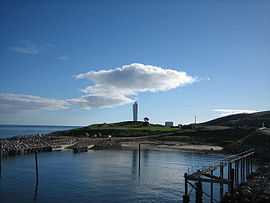
Sealink Terminal, Cape Jervis | |
 Cape Jervis | |
| Coordinates | 35°36′0″S 138°06′0″E / 35.60000°S 138.10000°ECoordinates: 35°36′0″S 138°06′0″E / 35.60000°S 138.10000°E |
| Population | 295 (2006 census)[1] |
| Postcode(s) | 5204[2] |
| Location | 108.4 km (67 mi) from Adelaide |
| LGA(s) | District Council of Yankalilla |
| State electorate(s) | Finniss |
| Federal Division(s) | Mayo |
Cape Jervis (postcode: 5204) is a town located near the western tip of Fleurieu Peninsula in South Australia on the southern end of the Main South Road approximately 108 kilometres (67 mi) south of Adelaide.[3]
It is named after the headland at the western tip[4] of Fleurieu Peninsula which was named by Matthew Flinders after John Jervis, 1st Earl of St Vincent on 23 March 1802.[5]
It overlooks the coastline adjoining the following three bodies of water - Gulf St Vincent, Investigator Strait and Backstairs Passage. It also overlooks the following facilities both located at the headland of Cape Jervis - the Cape Jervis Lighthouse and the port used by Kangaroo Island SeaLink who operates the ferry service to Penneshaw on Kangaroo Island.[6][7][8]
The population is approximately 300 people[1] and growing rapidly, with a new estate (Cape Jervis Heights) situated behind the main town. Cape Jervis is located within the local government area of the District Council of Yankalilla.[6]
Cape Jervis is the starting point for the Heysen Trail, a walking track of 1,200 kilometres (750 mi) length which finishes at Parachilna Gorge in the Flinders Ranges.[9] Venues of interest to visitors to the town include the Deep Creek Conservation Park, the Talisker Conservation Park and two nearby beaches - Morgan's Beach (with the remains of the trawler Ellen) and Fisheries Beach (with remains of an old whaling station).[6] Cape Jervis is also notable as a point of embarkment for fishing charters.[6]
References
- ↑ 1.0 1.1 Australian Bureau of Statistics (25 October 2007). "Cape Jervis (State Suburb)". 2006 Census QuickStats. Retrieved 2008-10-23.
- ↑ Cape Jervis Postcode Australia Post
- ↑ Development Plan, Yankililla (DC) Consolidated – 10 January 2013 (PDF). page= 54/234: Government of South Australia. 2014. Retrieved 27 November 2014.
- ↑ National Geospatial-Intelligence Agency (2010). Pub175, Sailing directions (enroute) north, west, and south coast of Australia (PDF) (10th ed.). National Geospatial-Intelligence Agency (NGA). p. 210. Retrieved 16 May 2014.
- ↑ "Jervis, Cape (The Manning Index of South Australian History)". The State Library of South Australia. Retrieved 27 November 2014.
- ↑ 6.0 6.1 6.2 6.3 "Towns". The District Council of Yankalilla. Retrieved 27 November 2014.
- ↑ "Cape Jervis (2)". Russ Rowlett and the University of North Carolina at Chapel Hill. Retrieved 27 November 2014.
- ↑ "Getting You to iconic Kangaroo Island". Sealink Travel Group. Retrieved 27 November 2014.
- ↑ "The Heysen Trail". Department of Environment, Water and Natural Resources. Retrieved 27 November 2014.
| ||||||||||||||||||||||||||||||||||||
| ||||||