Cape Bailey Light
 Cape Bailey Light, 2007 | |
|
| |
| Location | Kurnell, New South Wales, Australia |
|---|---|
| Coordinates | 34°2′6.56″S 151°13′20.05″E / 34.0351556°S 151.2222361°ECoordinates: 34°2′6.56″S 151°13′20.05″E / 34.0351556°S 151.2222361°E |
| Year first constructed | 1950 |
| Construction | concrete |
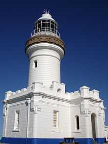
| Tower shape | square, lantern |
| Markings / pattern | white |
| Height | 30 feet (9.1 m) |
| Focal height | 180 feet (55 m) |
| Intensity | 1,200 cd |
| Range | 13 nautical miles (24 km)[1] |
| Characteristic | four white flashes, separated by 2s, every 16s[2] |
| Admiralty number | K2622 |
| NGA number | 111-6404 |
| ARLHS number | AUS-019 |
Cape Bailey Light is an active lighthouse located at Cape Bailey, a headland at the south side of the entrance to Botany Bay, New South Wales, Australia. The light serves in help north-bound shipping hug the coast to avoid the strong southerly currents further out to sea.
History
The light was first considered in 1931 but only constructed in 1950. Its lantern enclosure was taken from an unknown late-19th-century lighthouse. It is currently solar powered.
Site operation
The light is operated by the Australian Maritime Safety Authority, while the site is managed by Department of Environment, Climate Change and Water as part of the Botany Bay National Park.
Visiting
The site is open, and accessible by a hike of about 2.5 hours round trip from the end of Solander Road in Kurnell, but the tower is closed.
See also
| Wikimedia Commons has media related to Cape Bailey Lighthouse. |
References
Notes
General references
- List of Lights, Pub. 111, The West Coasts of North and South America (Excluding Continental U.S.A. and Hawaii), Australia, Tasmania, New Zealand, and the Islands of the North and South Pacific Oceans (PDF). List of Lights. United States National Geospatial-Intelligence Agency. 2009. p. 131.
- Rowlett, Russ. "Lighthouses of Australia: New South Wales". The Lighthouse Directory. University of North Carolina at Chapel Hill. Retrieved 2010-08-29.
- "The Cape Bailey Light at the entrance to Botany Bay". Lighthouses of New South Wales. Lighthouses of Australia Inc.
- Searle, Garry. "Cape Bailey". Lighthouses of New South Wales. SeaSide Lights.
External links
| |||||||||||||||||||||||||