Cantel, Guatemala
| Cantel | |
|---|---|
| Municipality and town | |
|
Cantel from a main road Quetzaltenango - Retalhueu | |
 Cantel | |
| Coordinates: 14°48′40.4″N 91°27′19.84″W / 14.811222°N 91.4555111°W | |
| Country |
|
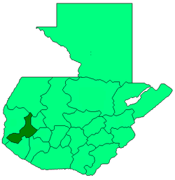
| Department |
|
| Area | |
| • Total | 8 sq mi (22 km2) |
| Population (2006) | |
| • Total | 32,221 |
| Time zone | Central Time (UTC+6) |
| Climate | Cwb |

Cantel is a small municipality in the Quetzaltenango Department in Guatemala, east from the city of Quetzaltenango with an area of 22 km2. The village of Cantel is situated at 2,370 m altitude. The population is 32,221 people.
Cantel includes the small Maya archaeological site of Chojolom.
External links
| Wikimedia Commons has media related to Cantel. |
Coordinates: 14°48′40.40″N 91°27′19.84″W / 14.8112222°N 91.4555111°W