Cannero Riviera
| Cannero Riviera | |
|---|---|
| Comune | |
| Comune di Cannero Riviera | |
 | |
 Cannero Riviera Location of Cannero Riviera in Italy | |
| Coordinates: 46°1′N 8°41′E / 46.017°N 8.683°ECoordinates: 46°1′N 8°41′E / 46.017°N 8.683°E | |
| Country | Italy |
| Region | Piedmont |
| Province | Verbano-Cusio-Ossola (VB) |
| Frazioni | Barbè, Donego, Cassino, Cheggio, Oggiogno, Piancassone, Ponte |
| Government | |
| • Mayor |
Maria Pia Bottacchi (elected 2004-06-13) |
| Area | |
| • Total | 14.46 km2 (5.58 sq mi) |
| Elevation | 212 m (696 ft) |
| Population (31 May 2006) | |
| • Total | 1,073 |
| • Density | 74/km2 (190/sq mi) |
| Demonym | Canneresi |
| Time zone | CET (UTC+1) |
| • Summer (DST) | CEST (UTC+2) |
| Postal code | 28051 |
| Dialing code | 0323 |
| Patron saint | Madonna del Carmine |
| Saint day | Second Monday of July |
| Website | Official website |
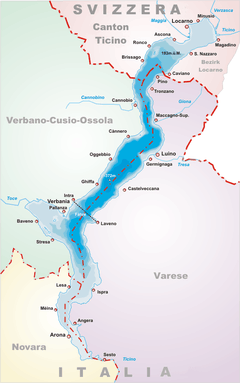
Cannero Riviera ([càn-ne-ro]; in Piedmontese Càner), is a comune with a population of 1,073 and an area of 14.46 square kilometres (5.58 sq mi) in the Province of Verbano-Cusio-Ossola in the Italian region Piedmont. The settlement is situated on the western shore of Lago Maggiore; it is about 130 kilometres (81 mi) northeast of Turin and about 15 kilometres (9 mi) northeast of Verbania.
Cannero Riviera borders the following municipalities: Aurano, Cannobio, Oggebbio, Trarego Viggiona; and across the lake in the Lombard Province of Varese: Brezzo di Bedero, Germignaga, Luino.
The 19th-century politician Massimo D’Azeglio spent his last years in his villa here.
See also
 Media related to Cannero Riviera at Wikimedia Commons
- Castelli di Cannero
Demographic evolution

References
- Most demographics and other statistics sourced from the Italian statistical institute Istat.
External links
- www.cannero.it/
- Official Tourism Gateway Lake Maggiore Official Tourism Gateway
| |||||||||||||||||||||||||||||||||