Canjadude
| Canjadude | |
|---|---|
| Village | |
|
PAIGC missile in the former Portuguese army barracks of Canjadude, 1973 | |
 Canjadude Location in Guinea-Bissau | |
| Coordinates: 12°5′N 14°14′W / 12.083°N 14.233°WCoordinates: 12°5′N 14°14′W / 12.083°N 14.233°W | |
| Country |
|
| Region | Gabú Region |
| Sector | Piche |
| Time zone | GMT (UTC+0) |
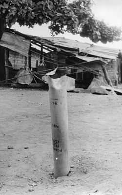
Canjadude is a village in the Gabú Region of northeastern Guinea-Bissau. It lies to the south of Uelíngarà.[1][2]Canjadude, along with Catió and other camps were besieged by the Portuguese in 1973.[3]
References
- ↑ Google Maps (Map). Google.
- ↑ Bing Maps (Map). Microsoft and Harris Corporation Earthstar Geographics LLC.
- ↑ Translations on Sub-Saharan Africa, Issues 1390-1397. United States. Joint Publications Research Service. 1973. p. 29.
External links
| |||||||||||||||||