Canisteo (village), New York
| Canisteo, New York | |
|---|---|
| Village | |
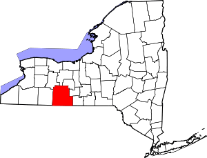
 Canisteo, New York Location within the state of New York | |
| Coordinates: 42°16′13″N 77°36′24″W / 42.27028°N 77.60667°WCoordinates: 42°16′13″N 77°36′24″W / 42.27028°N 77.60667°W | |
| Country | United States |
| State | New York |
| County | Steuben |
| Area | |
| • Total | 1.0 sq mi (2.5 km2) |
| • Land | 1.0 sq mi (2.5 km2) |
| • Water | 0.0 sq mi (0.0 km2) |
| Elevation | 1,135 ft (346 m) |
| Population (2000) | |
| • Total | 2,336 |
| • Density | 2,415.1/sq mi (932.5/km2) |
| Time zone | Eastern (EST) (UTC-5) |
| • Summer (DST) | EDT (UTC-4) |
| ZIP code | 14823 |
| Area code(s) | 607 |
| FIPS code | 36-12254 |
| GNIS feature ID | 0945774 |
Canisteo is a village in Steuben County, New York, United States. The population was 2,336 at the 2000 census.
The Village of Canisteo is in the northwest corner of the Town of Canisteo and is southeast of Hornell, New York.
History
An Indian village on this site, Kanestio Castle, was destroyed in 1765 by Sir William Johnson. Settlers began arriving at the new community around 1789. It was one of the first settlements in what is today Steuben County. The largest growth came after the American Civil War when many factories opened. The village was incorporated in 1873.
Schools
In the Village of Canisteo are located the Canisteo-Greenwood Elementary, Middle, and High Schools.
Transportation
The former Erie Railroad line passed to the east of Canisteo, and passenger service was provided, though ending in the 1940s. While it operated, a trolley connected the depot with the center of town. From 1892 until the 1920s Canisteo was linked to Hornell by trolley.[1] It was replaced by bus service, although there have been gaps when no public transportation was available. From 1896 to 1936, the New York & Pennsylvania Railroad (not to be confused with the Western New York and Pennsylvania Railway) ran south through Canisteo toward Rexville.
Flood Control System
The village of Canisteo was severely impacted by the floods of 1935, until that time the greatest since modern settlement began. Using federal funding, two levees were constructed, one beginning on the northwest of the village, ending on the southeast, protecting it from the Canisteo River. The other was built to the west of the village, protecting it from Bennett's Creek and Purdy Creek. The current bridges of Route 36 over Bennett's Creek and Route 248 over Purdy Creek were also constructed as part of this project, as was the village's sewer system.[2] The only flooding in the village since this construction was a result of Hurricane Agnes, in 1972, at which the Canisteo River reached its highest recorded height.
Living Sign
The village is home of the "world famous living sign" which was once featured in a Ripley's "Believe it or Not!" book. The sign spells out the name of the village in Scots Pine trees and has been around for more than fifty years. It is maintained by the local school and is viewable from Greenwood street near the elementary school. The sign, which has almost a perfect North/South axis, is still used by the armed services to orient true north when flying over it. The Canisteo Living Sign was listed on the National Register of Historic Places in 2004.[3]
USS Canisteo
A US Navy fleet oil frigate (AO-99) once held the name USS Canisteo. It was utilized until the 1990s and even served time as part of the Cuban blockade during the missile crisis of the 1960s. The ship's official motto was "If freedom were easy we wouldn't be here".
Geography
Canisteo is located at 42°16′12″N 77°36′23″W / 42.27000°N 77.60639°W (42.270178, -77.606616).[4]
According to the United States Census Bureau, the village has a total area of 1.0 square miles (2.5 km²).None of the area is covered with water.
The village is located at the junction of New York State Route 36 and New York State Route 248. County Route 28 joins New York State Route 36 south of the village and County Route 119 passes the north side of Canisteo.
The Canisteo River, flowing southeasterly, passes the north side of the village, where it is joined by Bennetts Creek.
Demographics
As of the census[5] of 2000, there were 2,336 people, 948 households, and 626 families residing in the village. The population density was 2,415.1 people per square mile (929.8/km²). There were 1,024 housing units at an average density of 1,058.7 per square mile (407.6/km²). The racial makeup of the village was 98.16% White, 0.21% Black or African American, 0.17% Native American, 0.51% Asian, 0.26% from other races, and 0.68% from two or more races. Hispanic or Latino of any race were 1.16% of the population.
There were 948 households out of which 29.6% had children under the age of 18 living with them, 51.2% were married couples living together, 10.5% had a female householder with no husband present, and 33.9% were non-families. 29.2% of all households were made up of individuals and 15.4% had someone living alone who was 65 years of age or older. The average household size was 2.46 and the average family size was 3.04.
In the village the population was spread out with 26.6% under the age of 18, 7.1% from 18 to 24, 24.8% from 25 to 44, 25.5% from 45 to 64, and 15.9% who were 65 years of age or older. The median age was 39 years. For every 100 females there were 89.5 males. For every 100 females age 18 and over, there were 85.9 males.
The median income for a household in the village was $32,269, and the median income for a family was $42,560. Males had a median income of $31,129 versus $22,857 for females. The per capita income for the village was $14,818. About 7.8% of families and 10.6% of the population were below the poverty line, including 8.9% of those under age 18 and 3.1% of those age 65 or over.
Sister cities
The following city has been identified as a sister city of Canisteo by Sister Cities International:[6]
References
- ↑ John S. Babbitt, Steuben County, Charleston, S.C., Arcadia, 2010, ISBN 978073857283, p. 68, http://books.google.com/books?id=uGhtyjGllFQC&pg=PA69&lpg=PA69&dq=%22canisteo+academy%22+telescope&source=bl&ots=LGcix-98D3&sig=UQO72oR4YFcSKe88YIVmYLInZuU&hl=en&sa=X&ei=aItPVKC1EIiqgwS1qYPQDA&ved=0CB4Q6AEwAA#v=onepage&q=%22canisteo%20academy%22%20telescope&f=false, consulted 10-24-2014.
- ↑ New York State Department of Environmental Conservation, "Canisteo Flood Damage Reduction Project", http://www.dec.ny.gov/docs/water_pdf/fcpprjcanteo.pdf, consulted 10-24-2014.
- ↑ Virginia L. Bartos (February 2004). "National Register of Historic Places Registration: Canisteo Living Sign". New York State Office of Parks, Recreation and Historic Preservation. Retrieved 2009-10-31.
- ↑ "US Gazetteer files: 2010, 2000, and 1990". United States Census Bureau. 2011-02-12. Retrieved 2011-04-23.
- ↑ "American FactFinder". United States Census Bureau. Retrieved 2008-01-31.
- ↑ "Online Directory: Australia". Sister Cities International. 2010. Retrieved 2010-09-01.
| |||||||||||||||||||||||||||||||||