Canadarago Lake
| Canadarago Lake | |
|---|---|
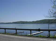 Canadarago Lake seen from NY 28 | |
| Location | Otsego County, New York |
| Coordinates | 42°48.9′N 75°00.4′W / 42.8150°N 75.0067°WCoordinates: 42°48.9′N 75°00.4′W / 42.8150°N 75.0067°W |
| Primary inflows | Ocquionis Creek |
| Primary outflows | Oaks Creek |
| Catchment area | 174 km2 (67 sq mi) |
| Basin countries | United States |
| Surface area | 7.6 km2 (1,900 acres) |
| Max. depth | 13 m (43 ft) |
| Surface elevation | 385 m (1,263 ft) |
| Islands | 1 (Deowongo Island) |
| Settlements | Richfield Springs, Schuyler Lake |
Canadarago Lake is the second largest lake in Otsego County, New York, USA, lying to the west of and parallel to the larger Otsego Lake.
The lake's name is also spelled "Candajarago Lake" or "Caniadaraga Lake".
Bordering areas
Canadarago lake runs from the Village of Richfield Springs at the north end to the community of Schuyler Lake at the south end. The lake has historically also been known as Schuyler Lake, and the community mentioned earlier still bears this name.
The northern end of the lake is in the Town of Richfield, and the southern end is in the Town of Exeter on the west and the Town of Otsego on the east.
The lake is surrounded by hills, used historically for agriculture.
Geography
The lake is located at 42°48.9′N 75°00.4′W / 42.8150°N 75.0067°W in central New York.
Canadarago Lake is a dimictic lake surviving a previous glacial period. The lake is approximately 5 miles (8.0 km) long and 1.5 miles (2.4 km) wide. There is a small island near the eastern shore. The surface area is 7.6 square kilometres (1,900 acres). The maximum depth is 13 meters (43 ft). The lake watershed drains 174 square kilometres (67 sq mi).
Ocquionis Creek feeds into the lake from the north, and Oaks Creek drains from the south through a bog, ultimately flowing into the Susquehanna River.
History
In 1872, a small steamboat was launched on the lake as a pleasure craft.
The island on Canadarago was called De-O-Won-Go by the Oneidas who lived in the area. The name is said to mean, "Place of Hearing", and was given to the island because of the echo that was noticeable from that body of land. The island was purchased from the State of New York by Daniel Wormer in 1850.
Until the early part of the 19th century, there was a second island on the lake. Smaller than the island that remains on Canadarago today, the "sunken island" was only half an acre in size. Its southern shore was marshy, but the northern end of the island (toward Richfield Springs) had trees and vegetation. In 1816..."the year without a summer", there was an early spring thaw and the streams that feed Canadarago were running high. Their water flow covered the lake ice. A north wind blew the ice pack into the southern portion of the lake. Not long after that, there was a hard freeze and the winds shifted from out of the south. The ice pack, larger than before, was sent back in the opposite direction. The saw effect took off the surface soil of the island and took down the trees and vegetation. It has been under water ever since.
Incompletely treated sewage from Richfield Springs caused algae blooms, but better treatment instigated during the 1970s has abated this problem.
June 2006 saw massive flooding of its banks after record rainfall. Legislation to create a Canadarago Lake District was approved by the New York State Legislature in 2007 but was subsequently vetoed by Governor Eliot Spitzer.
Many cottages have been built around the lake.