Camou-Cihigue
| Camou-Cihigue | |
|---|---|
|
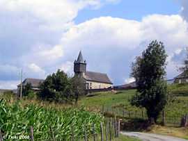
Church of Cihigue | |
 Camou-Cihigue | |
|
Location within Aquitaine region  Camou-Cihigue | |
| Coordinates: 43°07′02″N 0°54′17″W / 43.1172°N 0.9047°WCoordinates: 43°07′02″N 0°54′17″W / 43.1172°N 0.9047°W | |
| Country | France |
| Region | Aquitaine |
| Department | Pyrénées-Atlantiques |
| Arrondissement | Oloron-Sainte-Marie |
| Canton | Tardets-Sorholus |
| Intercommunality | Soule-Xiberoa |
| Government | |
| • Mayor (2008–2014) | Jean-Baptiste Aguer |
| Area1 | 10.08 km2 (3.89 sq mi) |
| Population (2006)2 | 114 |
| • Density | 11/km2 (29/sq mi) |
| INSEE/Postal code | 64162 / 64470 |
| Elevation |
208–1,009 m (682–3,310 ft) (avg. 263 m or 863 ft) |
|
1 French Land Register data, which excludes lakes, ponds, glaciers > 1 km² (0.386 sq mi or 247 acres) and river estuaries. 2 Population without double counting: residents of multiple communes (e.g., students and military personnel) only counted once. | |
Camou-Cihigue (Basque: Gamere-Zihiga) is a commune in the Pyrénées-Atlantiques department in south-western France.
It is located in the former province of Soule.
Geography
Neughboring communes:
- Ossas-Suhare, in the north
- Aussurucq, in the north-west
- Alos-Sibas-Abense, in the east
- Alçay-Alçabéhéty-Sunharette, in the south
History
The commune of Camou-Cihigue was formed in 1836, from the merger of the former commune of Camou Merged and the village of Cihigue.
See also
References
External links
| Wikimedia Commons has media related to Camou-Cihigue. |
- GAMERE-ZIHIGA in the Bernardo Estornés Lasa - Auñamendi Encyclopedia (Euskomedia Fundazioa) (Spanish)

| ||||||