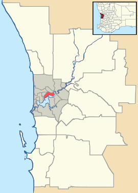
Camillo, Western Australia
| Camillo Perth, Western Australia | |||||||||||||
|---|---|---|---|---|---|---|---|---|---|---|---|---|---|
 Camillo Location in metropolitan Perth | |||||||||||||
| Coordinates | 32°06′54″S 116°00′07″E / 32.115°S 116.002°ECoordinates: 32°06′54″S 116°00′07″E / 32.115°S 116.002°E | ||||||||||||
| Population | 4,570 (2011 census)[1] | ||||||||||||
| • Density | 1,830/km2 (4,730/sq mi) | ||||||||||||
| Postcode(s) | 6111 | ||||||||||||
| Area | 2.5 km2 (1.0 sq mi) | ||||||||||||
| Location |
| ||||||||||||
| LGA(s) | City of Armadale | ||||||||||||
| State electorate(s) | Armadale | ||||||||||||
| Federal Division(s) | Canning | ||||||||||||
| |||||||||||||
Camillo is a southeastern suburb of Perth, Western Australia. Its local government area is the City of Armadale and it was part of Kelmscott until 1978. Until mid-2008,[2] it was named Westfield.
References
- ↑ Australian Bureau of Statistics (31 October 2012). "Camillo (State Suburb)". 2011 Census QuickStats. Retrieved 16 February 2014.
- ↑ "Camillo approved as new name for Westfield". City of Armadale. 4 June 2008. Retrieved 7 February 2014.