Camélas
| Camélas | |
|---|---|
|
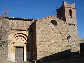
The church of Saint-Fructeux, in Camélas | |
 Camélas | |
|
Location within Languedoc-Roussillon region  Camélas | |
| Coordinates: 42°39′08″N 2°42′20″E / 42.6522°N 2.7056°ECoordinates: 42°39′08″N 2°42′20″E / 42.6522°N 2.7056°E | |
| Country | France |
| Region | Languedoc-Roussillon |
| Department | Pyrénées-Orientales |
| Arrondissement | Perpignan |
| Canton | Thuir |
| Intercommunality | Aspres |
| Government | |
| • Mayor (2014-2020) | Roger Bort |
| Area1 | 12.72 km2 (4.91 sq mi) |
| Population (1999)2 | 396 |
| • Density | 31/km2 (81/sq mi) |
| INSEE/Postal code | 66033 / 66300 |
| Elevation |
118–520 m (387–1,706 ft) (avg. 350 m or 1,150 ft) |
|
1 French Land Register data, which excludes lakes, ponds, glaciers > 1 km² (0.386 sq mi or 247 acres) and river estuaries. 2 Population without double counting: residents of multiple communes (e.g., students and military personnel) only counted once. | |
Camélas (Catalan: Cameles) is a commune in the Pyrénées-Orientales department in southern France.
Geography
Camélas is located in the canton of Thuir and in the arrondissement of Perpignan.

Map of Camélas and its surrounding communes
See also
References
| Wikimedia Commons has media related to Camélas. |