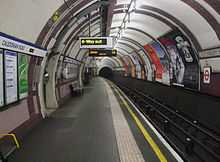
Caledonian Road tube station
| Caledonian Road | |
|---|---|
|
| |
 Caledonian Road Location of Caledonian Road in Greater London | |
| Location | Holloway |
| Local authority | Islington |
| Managed by | London Underground |
| Number of platforms | 2 |
| Accessible | Yes [1] |
| Fare zone | 2 |
| London Underground annual entry and exit | |
| 2010 |
|
| 2011 |
|
| 2012 |
|
| 2013 |
|
| Railway companies | |
| Original company | Great Northern, Piccadilly and Brompton Railway |
| Key dates | |
| 15 December 1906 | Station opened |
| Listed status | |
| Listing grade | II |
| Entry number | 1401086[3] |
| Added to list | 20 July 2011 |
| Other information | |
| Lists of stations | |
| London Transport portalCoordinates: 51°32′54″N 0°07′07″W / 51.5483°N 0.1186°W | |
Caledonian Road is a station on the Piccadilly line of the London Underground, between King's Cross St. Pancras and Holloway Road, and in Travelcard Zone 2. It was opened on 15 December 1906 by the Great Northern, Piccadilly and Brompton Railway.
Caledonian Road station is located on Caledonian Road in Holloway, north London. The station continues to use lifts, never having been upgraded to escalators. Unusually for stations of its era, the lifts descend directly to platform level with no secondary staircases. In recent times this has meant that the station is now advertised as "Step Free" on line maps without rebuilding work taking place. The station is a Grade II listed building.[4]
The next northbound station from Caledonian Road is Holloway Road while the next southbound station was originally York Road. This station closed in 1932, but can still be seen from trains. York Road was planned to be open to relieve congestion at King's Cross St. Pancras.
Service Pattern
The typical off-peak service from this station is as follows:
- 12 tph to Heathrow Airport via Central London (of which six serve terminals 4 and 1,2,3; while six serve terminals 1,2,3 and 5)
- 3 tph to Rayners Lane via Central London
- 3 tph to Uxbridge via Central London and Rayners Lane
- 3 tph to Northfields via Central London
- 18 tph to Cockfosters
- 3 tph to Arnos Grove
| Preceding station | Following station | |||
|---|---|---|---|---|
| Piccadilly line | towards Cockfosters |
|||
| Former Route | ||||
| Piccadilly line | towards Cockfosters |
|||
Location
The station is close to Pentonville Prison and Caledonian Park, the site of the former Victorian Metropolitan Cattle Market, is a short distance away on Market Road.
Platform Level Tiling

The stations along the central part of the Piccadilly line, as well as some sections of the Northern line, were financed by Charles Yerkes,[5] and are famous for the Leslie Green designed red station buildings and distinctive platform tiling. Each station has its own unique tile pattern and colours.
Connections
London Buses routes 17; 91 and 259 serve the station with 274 nearby.
Out of Station Interchange
Caledonian Road and Barnsbury station on the North London Line is about half a mile to the south.
References
| Wikimedia Commons has media related to Caledonian Road tube station. |
- ↑ "Step free Tube Guide" (PDF). Transport for London. Archived (PDF) from the original on 26 January 2015.
- ↑ 2.0 2.1 2.2 2.3 "Multi-year station entry-and-exit figures" (XLS). London Underground station passenger usage data. Transport for London. 2014. Retrieved 27 July 2014.
- ↑ Historic England. "Caledonian Road Underground Station (1401086)". National Heritage List for England. Retrieved 3 April 2015.
- ↑ "16 London Underground Stations Listed At Grade II". English Heritage. Archived from the original on 14 September 2011.
- ↑ http://www.londonreconnections.com/2010/the-man-who-painted-london-red/
| ||||||||||||||||||||||||||||||||||