Cairo, Ohio
| Cairo, Ohio | |
|---|---|
| Village | |
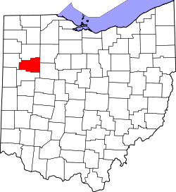
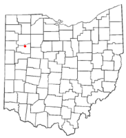 Location of Cairo, Ohio | |
| Coordinates: 40°49′53″N 84°5′4″W / 40.83139°N 84.08444°WCoordinates: 40°49′53″N 84°5′4″W / 40.83139°N 84.08444°W | |
| Country | United States |
| State | Ohio |
| County | Allen |
| Township | Monroe |
| Area[1] | |
| • Total | 0.23 sq mi (0.60 km2) |
| • Land | 0.23 sq mi (0.60 km2) |
| • Water | 0 sq mi (0 km2) |
| Elevation[2] | 814 ft (248 m) |
| Population (2010)[3] | |
| • Total | 524 |
| • Estimate (2012[4]) | 541 |
| • Density | 2,278.3/sq mi (879.7/km2) |
| Time zone | Eastern (EST) (UTC-5) |
| • Summer (DST) | EDT (UTC-4) |
| ZIP code | 45820 |
| Area code(s) | 419 |
| FIPS code | 39-10884[5] |
| GNIS feature ID | 1056752[2] |
Cairo (/ˈkɛəroʊ/ KAIR-oh) is a village in Allen County, Ohio, United States. As of the 2010 census it had a population of 524.[6] It is included in the Lima Metropolitan Statistical Area. As indicated above, the village's name is pronounced differently from the English name for the Egyptian city having the same spelling: listen.
Geography
Cairo is located at the intersection of what was the east-west U.S. Route 30 (the Lincoln Highway) and the north-south State Route 65 ("Ottawa Road") in the middle of farming country. In the 1970s, Route 30 was upgraded and moved approximately one mile south of Cairo. Now, the east-west street in Cairo is Main Street. Cairo lies near the following towns:
- Lima, about six miles to the south on State Route 65
- Columbus Grove, about six miles to the north on State Route 65
- Gomer, about five miles to the west on the old Lincoln Highway route
- Beaverdam, about six miles to the east on the old Lincoln Highway route
The elevation of the land area of Cairo (ranges from about 812' at the west end to 842' at the east end of the village above sea level) is benchmarked at 815 feet (248 m) above sea level, generally flat and moderately wooded. The nearest stream with year-round flow is Rattlesnake Creek, which flows from south of the village and passes just to the west of the village. Water flow in the village is generally from the south and east to the north and west.
According to the United States Census Bureau, the village has a total area of 0.23 square miles (0.60 km2), all land.[1]
Demographics
2010 census
As of the census[3] of 2010, there were 524 people, 198 households, and 150 families residing in the village. The population density was 2,278.3 inhabitants per square mile (879.7/km2). There were 214 housing units at an average density of 930.4 per square mile (359.2/km2). The racial makeup of the village was 97.7% White, 0.6% African American, 0.2% Native American, 0.2% Asian, and 1.3% from two or more races. Hispanic or Latino of any race were 1.5% of the population.
There were 198 households of which 37.9% had children under the age of 18 living with them, 58.1% were married couples living together, 14.1% had a female householder with no husband present, 3.5% had a male householder with no wife present, and 24.2% were non-families. 22.7% of all households were made up of individuals and 11.1% had someone living alone who was 65 years of age or older. The average household size was 2.65 and the average family size was 3.10.
The median age in the village was 37.2 years. 28.2% of residents were under the age of 18; 7.7% were between the ages of 18 and 24; 24.1% were from 25 to 44; 27.2% were from 45 to 64; and 13% were 65 years of age or older. The gender makeup of the village was 46.6% male and 53.4% female.
2000 census
As of the census[5] of 2000, there were 499 people, 181 households, and 148 families residing in the village. The population density was 2,064.0 people per square mile (802.8/km²). There were 184 housing units at an average density of 761.1 per square mile (296.0/km²). The racial makeup of the village was 98.60% White, 0.40% African American, 0.20% Asian, and 0.80% from two or more races. Hispanic or Latino of any race were 0.80% of the population.
There were 181 households out of which 40.9% had children under the age of 18 living with them, 65.2% were married couples living together, 12.7% had a female householder with no husband present, and 18.2% were non-families. 15.5% of all households were made up of individuals and 7.2% had someone living alone who was 65 years of age or older. The average household size was 2.76 and the average family size was 3.08.
In the village the population was spread out with 30.7% under the age of 18, 6.8% from 18 to 24, 31.5% from 25 to 44, 21.4% from 45 to 64, and 9.6% who were 65 years of age or older. The median age was 34 years. For every 100 females there were 92.7 males. For every 100 females age 18 and over, there were 90.1 males.
The median income for a household in the village was $32,917, and the median income for a family was $39,375. Males had a median income of $34,250 versus $25,313 for females. The per capita income for the village was $14,365. About 6.8% of families and 6.9% of the population were below the poverty line, including 11.4% of those under age 18 and 3.8% of those age 65 or over.
Points of interest
Formerly known as West Cairo, Cairo is a village having a population in 2010 of 524. Cairo was incorporated April 12, 1875.
Cairo is the hometown of Robert Franklin Jones, attorney and United States Congressman from 1939 to 1947.
Main Street in Cairo was a part of the country's first coast to coast road, the Lincoln Highway. At various times, there were Lincoln Highway markers and monuments along Main Street. The log building located at the Northeast corner of Main Street and Route 65 is known locally as the Lincoln Log Cabin. According to an article in the April 17, 2013 Lima News, the Log Cabin was built in 1848 by B. D. Hartzog who operated a general store there.
The village and local farm children once attended elementary school, grades 1 through 8, in Cairo and had a choice of attending either Columbus Grove or Lima Central high schools. The village was formerly a part of the Cairo Local School District. However, after the consolidation of Cairo into Bath Local School District in the 1970s the children attend the Bath elementary and secondary schools. The Cairo Elementary building was partially demolished. The gymnasium was spared and converted into a community center.
The most distinctive physical feature of Cairo is a painted (white) concrete grain elevator locally known as a "bean dryer" which is about 150 feet (46 m) tall.
Just south of town on Route 65 is Lake Cody Campground.
There is a small war memorial listing the local residents who served in the armed forces during World War II. The memorial is located on the north side of Main Street about 250 feet west of CSX Transportation tracks, near the building housing the post office.
The former Baltimore & Ohio Railroad ("the B&O",) now a CSX line, passes through Cairo north-south about ½ mile east of and generally parallel to State Route 65. Formerly, the Detroit, Toledo and Ironton Railroad ("the DT&I") passed through Cairo paralleling the Baltimore & Ohio right of way but about 300 feet to the east. The DT&I right-of-way is still obvious but the track was removed in the 1970s. The DT&I's successor, the Indiana & Ohio, runs through via trackage rights on the CSX. As many as 20-25 trains a day pass through Cairo on this busy rail line.
Cairo has two churches, Methodist and Congregational Christian.
Cairo also has a public library.
The village has a single traffic control light located at the intersection of Main Street (the Lincoln Highway) and Ohio Route 65.
Sports history
Baseball has long been a significant part of the village's recreational and social activities. In 1985 the Cairo little league team finished the season with a 14-0 record and were Tourney Champs defeating all other local teams.
Cairo has been well known for over 50 years as a mecca for local softball teams, highlighted annually by the Labor Day Marathon Tournament. League and tournament play dominate the spring/summer activities at Memorial Park, along with all levels of youth baseball and softball.
References
- ↑ 1.0 1.1 "US Gazetteer files 2010". United States Census Bureau. Retrieved 2013-01-06.
- ↑ 2.0 2.1 "US Board on Geographic Names". United States Geological Survey. 2007-10-25. Retrieved 2008-01-31.
- ↑ 3.0 3.1 "American FactFinder". United States Census Bureau. Retrieved 2013-01-06.
- ↑ "Population Estimates". United States Census Bureau. Retrieved 2013-06-17.
- ↑ 5.0 5.1 "American FactFinder". United States Census Bureau. Retrieved 2008-01-31.
- ↑ "Geographic Identifiers: 2010 Demographic Profile Data (G001): Cairo village, Ohio". U.S. Census Bureau, American Factfinder. Retrieved July 5, 2013.
External links
| |||||||||||||||||||||||||||||