Cachet, Ontario
| Cachet | |
|---|---|
| Unincorporated community | |
| Coordinates: 43°53′18″N 79°20′42″W / 43.88833°N 79.34500°W | |
| Country | Canada |
| Province | Ontario |
| Regional municipality | York |
| City | Markham |
| Time zone | EST (UTC-5) |
| • Summer (DST) | EDT (UTC-4) |
| Area code(s) | 905 and 289 |
| NTS Map | 030M14 |
| GNBC Code | FEQSW |
Cachet (Pronunciation: cash-AY) is a community within north-central Unionville, Ontario, Canada. It is bounded by 16th Avenue to the south, Major Mackenzie Drive to the north, Warden Avenue to the east and Highway 404 to the west.
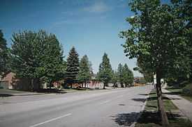
The area is a residential development that has replaced farm land that once defined the town. The residents of Cachet consist mostly of middle to upper-income families and the housing consists of large single family homes. The Cachet Centre is a small strip mall that services mainly to local residents. There is also an Asian shopping centre that would be opened soon at the intersection of Woodbine Avenue and Markland Street, called King Square. When the shopping centre is completed, it would be considered as the largest Asian mall in North America. It is to be completed around 2014. The population of the community is predominantly people of Chinese and small minority of European heritage.
The Rouge River and Berczy Creek flows through the community, but most of the natural areas of the community has disappeared to residential development. This neighborhood is also home to Ashton Meadows Public School, St. Monica Catholic Elementary School and St. Augustine Catholic High School. The Ashton Meadows community consists of government-housing. Many students who attended Ashton Meadows Public School go on to Pierre Elliott Trudeau High School, located at Berczy Village, on Bur Oak Avenue and Kennedy Road.
Transportation
Cachet is located a short distance from Highway 404 via the interchange at 16th Avenue. It is also a short distance from the Buttonville Airport, which is planned to be demolished soon and replaced with condominiums.
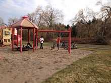
Parks
- Ashton Meadows Park
- Calvert Park
 |
Cathedraltown | | ||
| Richmond Hill | |
Angus Glen | ||
| ||||
| | ||||
| Unionville |
| ||||||||||
Coordinates: 43°53′18″N 79°20′42″W / 43.88833°N 79.34500°W