Cabin Creek (West Virginia)
| Cabin Creek | |
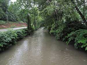 Cabin Creek near Ronda | |
| Country | United States |
|---|---|
| State | West Virginia |
| Counties | Fayette, Kanawha |
| Source | |
| - location | south-southwest of Coalfield |
| - elevation | 2,311 ft (704 m) [1] |
| - coordinates | 37°58′25″N 81°21′47″W / 37.9737203°N 81.3631638°W [2] |
| Mouth | Kanawha River |
| - location | Cabin Creek |
| - elevation | 591 ft (180 m) [2] |
| - coordinates | 38°11′56″N 81°28′48″W / 38.1989922°N 81.4801162°WCoordinates: 38°11′56″N 81°28′48″W / 38.1989922°N 81.4801162°W [2] |
| Length | 22.7 mi (37 km) |
| Basin | 73 sq mi (189 km2) |
| Hydrologic Unit Code | 0505000602 (USGS) |
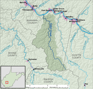 A map of Cabin Creek and its watershed
| |
Cabin Creek is a tributary of the Kanawha River, 22.7 miles (36.5 km) long,[3] in West Virginia in the United States. Via the Kanawha and Ohio rivers, it is part of the watershed of the Mississippi River, draining an area of 72.6 square miles (188 km2)[4] in a coal mining region on the unglaciated portion of the Allegheny Plateau.
Cabin Creek rises in western Fayette County, approximately 2.2 miles (3.5 km) south-southwest of Coalfield. It flows in southern Kanawha County for most of its course, north-northwestward through the unincorporated communities of Republic, Carbon, Decota, Laing, Quarrier, Holly, Leewood, Eskdale, Ohley, Coal, Giles, Dawes, Miami, Sharon, Ronda, and Dry Branch, to the community of Cabin Creek, where it flows into the Kanawha River. The creek is paralleled by county roads for most of its course, and additionally by the West Virginia Turnpike from Giles to its mouth.[5][6]
See also
References
- ↑ The National Map elevation for GNIS source coordinates. Retrieved 2013-11-14.
- ↑ 2.0 2.1 2.2 Geographic Names Information System. "Geographic Names Information System entry for Cabin Creek (Feature ID #1536826)". Retrieved 2013-11-14.
- ↑ United States Environmental Protection Agency. "West Virginia, Upper Kanawha Watershed". Archived from the original on 2013-11-14. Retrieved 2013-11-14.
- ↑ U.S. Geological Survey. National Hydrography Dataset, area data for Cabin Creek watershed, 10-digit Hydrologic Unit Code 0505000602. The National Map, retrieved 2013-11-14
- ↑ The National Map, accessed 2013-11-15
- ↑ West Virginia Atlas & Gazetteer. Yarmouth, Me.: DeLorme. 1997. p. 52-53. ISBN 0-89933-246-3.