Càrna
|
The southeast of Càrna looking towards Loch Teacuis and Morvern | |
| Location | |
|---|---|
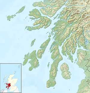 Càrna Càrna shown within Argyll and Bute | |
| OS grid reference | NM620590 |
| Names | |
| Gaelic name |
|
| Meaning of name | possibly cairn island |
| Physical geography | |
| Island group | Inner Hebrides |
| Area | 213 hectares (0.82 sq mi) |
| Area rank | 104 [1] |
| Highest elevation | Cruachan Chàrna 169 metres (554 ft) |
| Political geography | |
| Sovereign state | United Kingdom |
| Country | Scotland |
| Council area | Highland |
| Demographics | |
| Population | 0[2] |
| References | [3][4] |

Càrna (Scottish Gaelic pronunciation: [kʰaːrˠnə]) is an island in Loch Sunart, an arm of the sea, close to the Ardnamurchan peninsula, on the west coast of Scotland.
Geography
Càrna lies across the mouth of Loch Teacuis, forming two narrow kyles which provide some of the trickiest rock-dodging for yachtsmen anywhere on the west coast.[5] Moine schist bedrock of quartz-feldspar constitution, with mixed schists and mica schists in a west coastal strip.[3] A north-south ridge divides the island in two. From the heather covered rocky peak of Cruachan Chàrna, there are spectacular views over Oronsay, Loch Sunart, Morvern, Coll and Isle of Mull.[6]
Wildlife
A variety of habitats support willow warblers, redstarts, wheatears, whinchats, twites, herons, ostercatchers, cormorants, ravens and kestrels.[3][6] There are also eagles here, including occasional sea eagles.[6] Eilean nan Gabhar (goat island) to the south is often used by seals,[3][6] and there are also porpoises in the area.[6]
In 2013 it was announced that Càrna is to become a sanctuary for wildcats in order to protect the species, which is endangered in Scotland. A new breeding centre will be run by The Aspinall Foundation and a separate project on the mainland will involve the trapping and neutering of feral cats. Purebred wildcats reared on the island will be released into the wild.[7]
Economy and history
Càrna is thought to be more fertile than its neighbour, Oronsay. The northern part of the island is named Bac a' Mhathachaidh (Scottish Gaelic: "cultivated bank"). In common with many Scottish islands the population has declined since the 19th century. At one point up to 18 families lived there but by 1881 the population was seven. In 1891 it was recorded as ten but this had dropped to only two in 1961. No permanent population was recorded in 1981, 2001 or 2011.[2][3]
The island has been privately owned by the same family since the 1870s and has several holiday homes, although it is not permanently inhabited.[3][6] The crofter's cottage on Carna was made into a family home in the 1920s.[6]
A graveyard still remains above and behind the Caretakers house, which is still active. The last burial occurred there in 2009 when Margaret Hewer's ashes were scattered there. Her father Dr Earnshaw Hewer was also buried on Carna in 1931.[8]
Glencripesdale Estate

At its height the Glencripesdale Estate stretched for 32 kilometres (20 mi) along the entire south side of Loch Sunart, and the entire east side of Loch Teacuis. It comprised the smaller estates of Glencripesdale, Laudale and Rahoy, and measured 106 square kilometres (41 sq mi), and its centre point was the 27 bedroom Glencripesdale Castle. It was purchased in the 1870s by the three Newton brothers (Canon Horace Newton, Goodwin Newton & William Newton III). Dr. Earnshaw Hewer bought the island in 1922 when the rest of Glencripsedale was being sold, and Càrna is the last remaining part of this once huge holding, still owned by descendents of the Milward's Needles family, Earnshaw Hewer having been the grandson of Canon Horace.[8]
Footnotes
- ↑ Area and population ranks: there are c. 300 islands >20ha in extent and 93 permanently inhabited islands were listed in the 2011 census.
- ↑ 2.0 2.1 National Records of Scotland (15 August 2013) (pdf) Statistical Bulletin: 2011 Census: First Results on Population and Household Estimates for Scotland - Release 1C (Part Two). "Appendix 2: Population and households on Scotland’s inhabited islands". Retrieved 17 August 2013.
- ↑ 3.0 3.1 3.2 3.3 3.4 3.5 Haswell-Smith, Hamish. (2004) The Scottish Islands. Edinburgh. Canongate.
- ↑ Ordnance Survey. Get-a-map (Map). 1:25,000. Leisure. Ordinance Survey. Retrieved 21 August 2013.
- ↑ Lawrence, Martin (2004). Yachtsman's Pilot: Isle of Mull and adjacent coasts. Imray. ISBN 0-85288-692-6.
- ↑ 6.0 6.1 6.2 6.3 6.4 6.5 6.6 "Island website". Retrieved 2008-08-01.
- ↑ "Remote island plan to help save Scottish wildcats from extinction". The Herald. (23 September 2013) Glasgow. Retrieved 25 September 2013.
- ↑ 8.0 8.1 "Hewer, Edward Septimus Earnshaw (1875 - 1931)". Plarr's Lives of the Fellows Online. Retrieved 25 September 2013.
| ||||||||||||
